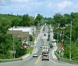
Marmora and Lake
| Marmora and Lake | |
|---|---|
| Municipality (lower-tier) | |
| Municipality of Marmora and Lake | |
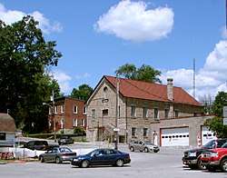 Municipal office in Marmora | |
 Marmora and Lake Location in southern Ontario | |
| Coordinates: 44°38′33″N 77°44′14″W / 44.64250°N 77.73722°WCoordinates: 44°38′33″N 77°44′14″W / 44.64250°N 77.73722°W[1] | |
| Country |
|
| Province |
|
| County | Hastings |
| Settled | 1821 |
| Incorporated | January 1, 2001 |
| Government | |
| • Type | Township |
| • Reeve | Terry Clemens |
| • Federal riding | Prince Edward—Hastings |
| • Prov. riding | Prince Edward—Hastings |
| Area[2] | |
| • Land | 556.19 km2 (214.75 sq mi) |
| Elevation[3] | 274 m (899 ft) |
| Population (2011)[2] | |
| • Total | 4,074 |
| • Density | 7.3/km2 (19/sq mi) |
| Time zone | UTC-5 (EST) |
| • Summer (DST) | UTC-4 (EDT) |
| Postal Code | K0K 2M0 |
| Area code(s) | 613 and 343 |
| Website |
www |
Marmora and Lake is a township municipality in Hastings County in Central Ontario, Canada.[1]
Communities
History
The original township of Marmora was named in 1820 for the Latin word for marble, while the adjoining Township of Lake was named for Viscount Gerard Lake. The two townships were joined to form the single municipality of Marmora and Lake . The village of Marmora separated from the township and was incorporated as a separate municipality in 1901.
Mining played an important role in the development of the area. Iron mining was particularly important in the area. Other minerals extracted from township mines include copper, lead, silver, gold and lithographic limestone. Today, talc and dolomite are processed in the municipality at the site of the former Bethlehem Steel Corporation iron ore open pit mine.
In 1998, the township expanded through an amalgamation of the Village of Deloro.
The current municipality was formed in 2001 through an amalgamation of the Village of Marmora and the existing Township of Marmora and Lake.
Demographics
| Canada census – Marmora and Lake community profile | |||
|---|---|---|---|
| 2011 | 2006 | ||
| Population: | 4074 (4.1% from 2006) | 3912 (-1.8% from 2001) | |
| Land area: | 556.19 km2 (214.75 sq mi) | 533.75 km2 (206.08 sq mi) | |
| Population density: | 7.3/km2 (19/sq mi) | 7.3/km2 (19/sq mi) | |
| Median age: | 50.9 (M: 50.2, F: 51.6) | 48.2 (M: 47.0, F: 49.8) | |
| Total private dwellings: | 2503 | 2213 | |
| Median household income: | $39,743 | ||
| References: 2011[4] 2006[5] earlier[6] | |||
According to the 2006 Census,[5] Marmora and Lake has a population of 3,912 permanent residents over an area of 533.75 square kilometres. This is a slight drop from 3,985 recorded in the 2001 census. Private dwellings occupied by usual residents amounted to 1598, whereas total dwellings are 2213. Mother tongue of its population is:
- English as first language: 92.5%
- French as first language: 1.5%
- English and French as first language: 0%
- Other as first language: 6.0%
Population trend:[7]
- Population in 2011: 4074
- Population in 2006: 3912
- Population in 2001: 3985
- Population in 1996:
- Deloro (village): 183
- Marmora (village): 1483
- Marmora and Lake (township): 2208
- Population in 1991:
- Deloro (village): 208
- Marmora (village): 1538
- Marmora and Lake (township): 1916
Government
Marmora and Lake Council As of 2010:
- Terry Clemens, Reeve
- Rita Cimprich, Deputy Reeve
- Linda Bracken, Councillor
- Sandy Fraser, Councillor
- Elaine Jones, Councillor
Provincial and federal representation:
- M.P.P. Todd Smith, Progressive Conservative Party of Ontario, for the provincial riding of Prince Edward—Hastings
- M.P. Daryl Kramp, Conservative Party of Canada, for the federal riding of Prince Edward—Hastings
Tourist attractions
- The old open pit iron ore mine just east of Marmora is open to the public for viewing.
See also
References
- 1 2 "Marmora and Lake". Geographical Names Data Base. Natural Resources Canada. Retrieved 2014-06-08.
- 1 2 "Marmora and Lake census profile". 2011 Census of Population. Statistics Canada. Retrieved 2012-03-02.
- ↑ Taken from Google Earth at geographic coordinates, accessed 2014-06-08.
- ↑ "2011 Community Profiles". Canada 2011 Census. Statistics Canada. July 5, 2013. Retrieved 2014-06-08.
- 1 2 "2006 Community Profiles". Canada 2006 Census. Statistics Canada. March 30, 2011. Retrieved 2012-03-02.
- ↑ "2001 Community Profiles". Canada 2001 Census. Statistics Canada. February 17, 2012.
- ↑ Statistics Canada: 1996, 2001, 2006 census
Other map sources:
- Map 6 (PDF) (Map). 1 : 700,000. Official road map of Ontario. Ministry of Transportation of Ontario. 2014. Retrieved 2014-06-08.
- Restructured municipalities - Ontario map #5 (Map). Restructuring Maps of Ontario. Ontario Ministry of Municipal Affairs and Housing. 2006. Retrieved 2014-06-08.
External links
Places adjacent to Marmora and Lake | |
|---|---|
| Cities | 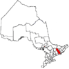 | |
|---|---|---|
| Towns | ||
| Townships | ||
| First Nations | ||
| Indian reserves | ||
| ||