Tweespruit
| Tweespruit | |
|---|---|
 Tweespruit  Tweespruit Tweespruit (South Africa)  Tweespruit Tweespruit (Africa) | |
| Coordinates: 29°11′08″S 27°01′44″E / 29.18556°S 27.02889°ECoordinates: 29°11′08″S 27°01′44″E / 29.18556°S 27.02889°E | |
| Country | South Africa |
| Province | Free State |
| District | Thabo Mofutsanyane |
| Municipality | Mantsopa |
| Area[1] | |
| • Total | 5.1 km2 (2.0 sq mi) |
| Population (2011)[1] | |
| • Total | 5,791 |
| • Density | 1,100/km2 (2,900/sq mi) |
| Racial makeup (2011)[1] | |
| • Black African | 90.5% |
| • Coloured | 5.3% |
| • Indian/Asian | 0.3% |
| • White | 3.5% |
| • Other | 0.4% |
| First languages (2011)[1] | |
| • Sotho | 84.3% |
| • Afrikaans | 9.1% |
| • English | 2.0% |
| • Sign language | 1.5% |
| • Other | 3.1% |
| Time zone | UTC+2 (SAST) |
| Postal code (street) | 9770 |
| PO box | 9770 |
| Area code | 051 |
Tweespruit is a small dairy farming town in the Free State province of South Africa. The town lies 27km east of Thaba Nchu and 47km north of Hobhouse.[2]
History
Afrikaans for "two creeks", the name refers to the town’s location at the confluence of two small rivers.[3]
The town started as an experimental farm set up on an old British Boer War settlement which was between two creeks, hence the name.
Notable people from Tweespruit
- Father Frans Claerhout, artist and priest at Tweespruit mission station.[4]
- Michael Anthony (Pez) Parsonson, SAAF fighter pilot.
Gallery
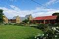 School Buildings - Tweespruit
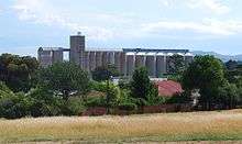 Grain Elevator in Tweespruit
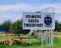 Tweespruit Primary School
References
- 1 2 3 4 Sum of the Main Places Tweespruit and Borwa from Census 2011.
- ↑ "Google Map - Hobhouse to Tweespruit".
- ↑ "Dictionary of Southern African Place Names (Public Domain)". Human Science Research Council. p. 441.
- ↑ South African History Online - SA Artist, Father Frans Claerhout, is born
Municipalities and communities of Thabo Mofutsanyana District Municipality, Free State | ||
|---|---|---|
District seat: Phuthaditjhaba (Witsieshoek) | ||
| Setsoto | .svg.png) | |
| Dihlabeng | ||
| Nketoana | ||
| Maluti-a-Phofung | ||
| Phumelela | ||
| Mantsopa | ||
This article is issued from
Wikipedia.
The text is licensed under Creative Commons - Attribution - Sharealike.
Additional terms may apply for the media files.