Tulloch, Perth and Kinross
| Tulloch | |
|---|---|
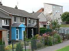 A row of terraced housing on Tulloch's Primrose Place | |
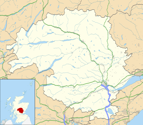 Tulloch Tulloch shown within Perth and Kinross | |
| OS grid reference | NO095255 |
| Council area | |
| Lieutenancy area | |
| Country | Scotland |
| Sovereign state | United Kingdom |
| Post town | PERTH |
| Postcode district | PH1 |
| Dialling code | 01738 |
| Police | Scottish |
| Fire | Scottish |
| Ambulance | Scottish |
| EU Parliament | Scotland |
| UK Parliament | |
| Scottish Parliament | |
Tulloch is a residential area of Perth, Scotland, approximately 1.5 miles (2.4 km) north-west of the centre of Perth. It is informally known as Hillyland.[1]
The main access road to Tulloch, from the east or west, is Tulloch Road, reached via the Crieff Road (A85), which bounds it to the south. It is also accessible, albeit less directly, from the Dunkeld Road (A912), which bounds it to the north-east, via a modern housing development. It is bounded to the north-west by the A9.
Tulloch has a small shopping precinct, Tulloch Square, located just off Tulloch Terrace. Tulloch Primary School, founded in 1969, is located on Gillespie Place,[2] itself located off Primrose Crescent, a main thoroughfare which, upon merging from Tulloch Road, circumnavigates Tulloch's oldest residential area before joining up with Tulloch Road again just before its western junction with Crieff Road. Perth's crematorium is located on Crieff Road.
The skyline is dominated by several high-rise flats (one of which is in view in the background of the infobox image).
In addition to the new housing development in the north-east of Tulloch, homes have also been built to the north and west. These are in addition to the first development (Sandeman Court) that went up in the 1980s in the valley behind the primary school, near the railway siding at the bottom of the hill. Between the housing and the railway siding is Perth Lade, which is sourced from Low's Work, a weir on the River Almond south of Almondbank, and empties 4.5 miles (7.2 km) away into the River Tay, near Smeaton's Bridge, via the city.[3] A walking path runs parallel to the lade. Ladeside Court, a cul-de-sac off Fairfield Avenue, takes its name from the body of water.
J. Pullar and Sons Ltd. Tulloch Works, a dry cleaning plant, once stood on the site of the present-day Bracken Brae.[4]
From certain parts of Tulloch, views are afforded of the hills beyond Scone to the east, including an obelisk on the 279-foot (85 m) summit of a hill near Muirend. To the north, the Grampian Mountains can be seen.
Sport
McDiarmid Park, the home of Perth's professional football club, St Johnstone, is located at the western edge of Tulloch, in close proximity to the crematorium, while junior club Kinnoull are based at Tulloch Park on Tulloch Road.[5]
Transport
Tulloch can be reached via the number 1 and number 2 buses from the centre of Perth. The number 1 originates from Mill Street;[6] the number 2 from South Street.[7]
Gallery
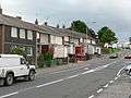 A view of Primrose Crescent, near its junction with Pullar Terrace.
References
- ↑ "Over £1million boost for home improvements in Hillyland" Archived 7 July 2013 at Archive.is - Perth & Kinrosshire Council, 24 May 2013
- ↑ "Tulloch Primary School at AXCIS.co.uk". Archived from the original on 5 August 2007. Retrieved 22 February 2008.
- ↑ A Perth Lade - Alder Archaeology
- ↑ Britain from Above
- ↑ "Perthshire junior football review, 26 January 2010" - Perthshire Advertiser, 26 January 2010
- ↑ Stagecoach - Timetables Archived 10 August 2013 at the Wayback Machine.
- ↑ Stagecoach - Timetables Archived 10 August 2013 at the Wayback Machine.
External links
- A view of Tulloch, looking west. Tulloch Primary School can be seen at the bottom. McDiarmid Park is just left of centre. To its left, the Crieff Road is seen extending into the distance.
- A photograph of a bus on Murray Street in Perth heading for Tulloch, via Letham
- Tulloch Primary School