Katikati
| Katikati | |
|---|---|
| Town | |
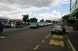 SH2 through the centre of Katikati | |
 Katikati | |
| Coordinates: 37°33′S 175°55′E / 37.550°S 175.917°ECoordinates: 37°33′S 175°55′E / 37.550°S 175.917°E | |
| Country |
|
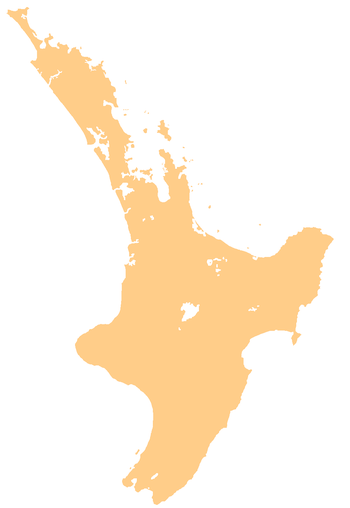
| Region | Bay of Plenty |
| Territorial authority | Western Bay of Plenty District |
| Ward | Waihi Beach/Katikati |
| Population (June 2017)[1] | |
| • Territorial | 4,630 |
| Time zone | UTC+12 (NZST) |
| • Summer (DST) | UTC+13 (NZDT) |
| Postcode(s) | 3129 |
Katikati is a town in New Zealand (North Island) located on the Uretara Stream near a tidal inlet towards the northern end of Tauranga Harbour, 28 kilometres south of Waihi and 40 kilometres northwest of Tauranga. State Highway 2 passes through the town; a bypass scheduled to have begun construction in 2008 is on hold.[2]
Katikati has become known for its many murals painted on walls of commercial buildings. These were started in the 1990s to regenerate tourist interest in the town and district, and led to the town being recgonised New Zealand's 'Most Beautiful Small Town' award for towns of less than 8,000 population in 2005 by the Keep New Zealand Beautiful Society.[3]
There are hot springs three kilometres to the south of Katikati at Sapphire Springs.[4]
History
Katikati was and remains a Maori community that derived from the waka Mātaatua and is affiliated with the tribal group in Tauranga, Ngāi Te Rangi.[5] It was later settled in 1875 by Ulster Scots people from County Tyrone in Ireland through the Orange Institution.[6]
The land upon which the town was built was confiscated from local Māori after the Land Wars and was given to the settlers by the Central Government. The settlement was established by the Irishman George Vesey Stewart, who led two groups of settlers there aboard the ships Carisbrook Castle (1875) and Lady Jocelyn (1878).[7]
The settlement was formed from two distinct groups: "the settlers useful" (tenant farmers) and "the settlers ornamental" (those with wealth). The settlement managed to withstand early economic problems and developed into a healthy town, based around farming and agriculture.[8]
Culture
There are two marae (tribal meeting grounds) in the Katikati area, associated with iwi (tribes) and hapū (sub-tribes), Both marae have a wharenui (meeting house). Te Rere a Tukahia marae is affiliated the Ngāi Te Rangi iwi and its Ngāi Tamawhariua hapū, and includes the Tamawhariua wharenui. Tuapiro marae is affiliated with the Ngāti Ranginui iwi and its Ngāti Te Wai hapū, and includes Ngā Kurī a Wharei.[5][9]
Education
Middle school education is provided by Katikati College (Years 7–13).[10] Katikati Primary School (Years 1–6)[11] and Matahui Road School (Years 1–8) supply primary education.[12]
Matahui Road School is an independent primary school that was established in 1988. It is governed by the Matahui Road School Charitable Trust.[13]
Notable people
- Alan Edward Mulgan, journalist, writer, and broadcaster
- Bunny Walters, singer
- Richard O'Brien, actor, director, and producer
See also
References
- ↑ "Subnational Population Estimates: At 30 June 2017 (provisional)". Statistics New Zealand. 24 October 2017. Retrieved 24 October 2017. For urban areas, "Subnational population estimates (UA, AU), by age and sex, at 30 June 1996, 2001, 2006-16 (2017 boundary)". Statistics New Zealand. 24 October 2017. Retrieved 24 October 2017.
- ↑ NZTA: Katikati Bypass Archived 2013-03-12 at the Wayback Machine.
- ↑ "Beautiful Cities and Towns 2005". Keep New Zealand Beautiful Societydeadurl=yes. Archived from the original on 2007-11-10.
- ↑ "Katikati Travel Guide". Jasons Travel Media.
- 1 2 "Te Kāhui Māngai directory". tkm.govt.nz. Te Puni Kōkiri.
- ↑ BBC Northern Ireland report
- ↑ Brett, Henry (1924). "The Lady Jocelyn". White Wings Vol I. Fifty Years Of Sail In The New Zealand Trade, 1850 to 1900. Auckland: NZETC (Victoria University of Wellington). pp. 40–43.
- ↑ "Untitled". The Bay of Plenty Times. 12 October 1878. pp. 2–3.
- ↑ "Māori Maps". maorimaps.com. Te Potiki National Trust.
- ↑ Te Kete Ipurangi schools database: Katikati College
- ↑ Te Kete Ipurangi schools database: Katikati Primary School
- ↑ Te Kete Ipurangi schools database: Matahui Road School
- ↑ Udy, Carly (23 November 2009). "Key becomes one of the kids on visit". The Bay of Plenty Times.
External links
| Wikimedia Commons has media related to Katikati. |