Tuao
| Tuao | ||
|---|---|---|
| Municipality | ||
| Municipality of Tuao | ||
| ||
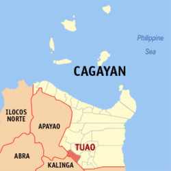 Map of Cagayan with Tuao highlighted | ||
.svg.png) Tuao Location within the Philippines | ||
| Coordinates: 17°44′N 121°27′E / 17.73°N 121.45°ECoordinates: 17°44′N 121°27′E / 17.73°N 121.45°E | ||
| Country |
| |
| Region | Cagayan Valley (Region II) | |
| Province | Cagayan | |
| District | 3rd District | |
| Founded | 1851 | |
| Barangays | 32 (see Barangays) | |
| Government [1] | ||
| • Type | Sangguniang Bayan | |
| • Mayor | Francisco N. Mamba Jr. | |
| • Electorate | 33,991 voters (2016) | |
| Area [2] | ||
| • Total | 215.50 km2 (83.21 sq mi) | |
| Population (2015 census)[3] | ||
| • Total | 61,535 | |
| • Density | 290/km2 (740/sq mi) | |
| Time zone | UTC+8 (PST) | |
| ZIP code | 3528 | |
| PSGC | 021528000 | |
| IDD : area code | +63 (0)78 | |
| Climate type | Tropical monsoon climate | |
| Income class | 1st municipal income class | |
| Revenue (₱) | 155,856,134.62 (2016) | |
| Native languages |
Ibanag Ilocano Itawis language Tagalog | |

Tuao, officially the Municipality of Tuao, is a 1st class municipality in the province of Cagayan, Philippines. According to the 2015 census, it has a population of 61,535 people.[3]
Barangays
Tuao is politically subdivided into 32 barangays.
- Accusilian
- Alabiao
- Alabug (Food Basket of Tuao)
- Angang
- Bagumbayan
- Barancuag
- Battung
- Bicok
- Bugnay
- Bulagao
- Cagumitan
- Cato
- Centro 1
- Centro 2
- Culong
- Dagupan
- Fugu
- Lakambini
- Lallayug
- Malalinta
- Malummin
- Mambacag
- Mungo
- Naruangan
- Palca
- Pata
- San Juan
- San Luis (Gurengad)
- San Vicente
- Santo Tomas
- Taribubu
- Villa Laida
History
When the early Spanish missionaries were busy laying the foundation of a church late in the 16th century at a site about six kilometers from the present town of Tuao, a big bird came circling over them and then alighted on the wooden cross erected to mark the place where the cornerstone was laid. It flapped its wings noisily, cried "battuao, battuao, battuao" and then flew away.
The native laborers in the construction stopped working and refused to continue telling the priests that the site had not been well chosen. They insisted that a party should find out where the bird had flown to.
To humor the pagan natives, one of the priests allowed himself to be led by a party of natives to look for the mysterious bird. To his surprise, they found the bird serenely perched on top of a tall tree on the edge of a wide clearing ideal for a town site. He sent one of the natives to call for the other priests, who, on their arrival, found the place much to their liking. And so the first church of Tuao was constructed on the site where the present edifice now stands.
When the civil authorities founded the town in 1604, the natives insisted that it be called Tuao. Eight years later on May 13, 1612, Tuao was accepted ecclesiastically. Father Miguel de San Jacinto, O.P. gave the town Santos Angeles Custudios (Holy Guardian Angels) as its patron saints.
The early missionaries in Tuao were zealous evangelists and tactful pacifiers of warlike natives. One of them was Father Francisco Capillas who later became the first martyr in China. The first parish priest, Father Juan B. Cano, O.P. worked patiently with the people.
A late comer, Father Gabriel Serrano, O.P. built a strong brick and mortar church, a rectory (convento) and a fort (cotta) in which the Spaniards and the natives sought refuge every time the town was raided by the Kalingas from the Caraballo ranges. Unfortunately, these priceless monuments to the politicalization and evangelization of Tuao by the Spaniards were destroyed by a strong earthquake on December 29, 1749.
In protest of abuses committed by some Spanish civil petty officials and soldiers, the inhabitants of Tuao and neighboring Malaueg, rose in revolt in 1781 under Magtangaga and Tomas Sinaguingan. The uprising was put down by Capitan Juan Pablo de Orduna.
Tuao became a part of events during World War II as the seat of the successful renaissance government of Governor Marcelo Adduru. The Japanese Forces garrisoned the town when Adduru was captured late in 1943, but Adduru returned shortly after having been freed by his guerilla soldiers early in 1944. Donald Blackburn, staged from Tuao, his guerrilla headquarters, attacks against the Japanese in Tuguegarao.[4]:299–302
After the war, the inhabitants work in silent diligence. Most of them used their brawn to make living, they are independent from outside help and are friendly people.
Demographics
| Population census of Tuao | ||
|---|---|---|
| Year | Pop. | ±% p.a. |
| 1903 | 7,214 | — |
| 1918 | 9,800 | +2.06% |
| 1939 | 14,228 | +1.79% |
| 1948 | 16,365 | +1.57% |
| 1960 | 23,257 | +2.97% |
| 1970 | 28,757 | +2.14% |
| 1975 | 31,597 | +1.91% |
| 1980 | 36,255 | +2.79% |
| 1990 | 43,926 | +1.94% |
| 1995 | 49,285 | +2.18% |
| 2000 | 53,536 | +1.79% |
| 2007 | 57,154 | +0.91% |
| 2010 | 57,620 | +0.30% |
| 2015 | 61,535 | +1.26% |
| Source: Philippine Statistics Authority[3][5][6][7] | ||
In the 2015 census, the population of Tuao was 61,535 people,[3] with a density of 290 inhabitants per square kilometre or 750 inhabitants per square mile.
References
- ↑ "Municipality". Quezon City, Philippines: Department of the Interior and Local Government. Retrieved 31 May 2013.
- ↑ "Province: Cagayan". PSGC Interactive. Quezon City, Philippines: Philippine Statistics Authority. Retrieved 12 November 2016.
- 1 2 3 4 Census of Population (2015). "Region II (Cagayan Valley)". Total Population by Province, City, Municipality and Barangay. PSA. Retrieved 20 June 2016.
- ↑ Harkins, P., 1956, Blackburn's Headhunters, London: Cassell & Co. LTD
- ↑ Census of Population and Housing (2010). "Region II (Cagayan Valley)". Total Population by Province, City, Municipality and Barangay. NSO. Retrieved 29 June 2016.
- ↑ Censuses of Population (1903–2007). "Region II (Cagayan Valley)". Table 1. Population Enumerated in Various Censuses by Province/Highly Urbanized City: 1903 to 2007. NSO.
- ↑ "Province of Cagayan". Municipality Population Data. Local Water Utilities Administration Research Division. Retrieved 17 December 2016.
External links
Places adjacent to Tuao | |
|---|---|
Tuguegarao (capital) | |
| Municipalities | |
| Component city | |
| Barangays | |