Gattaran
| Gattaran | ||
|---|---|---|
| Municipality | ||
| Municipality of Gattaran | ||
| ||
| Motto(s): Abante Kailian! | ||
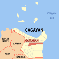 Map of Cagayan with Gattaran highlighted | ||
.svg.png) Gattaran Location within the Philippines | ||
| Coordinates: 18°04′N 121°39′E / 18.07°N 121.65°ECoordinates: 18°04′N 121°39′E / 18.07°N 121.65°E | ||
| Country |
| |
| Region | Cagayan Valley (Region II) | |
| Province | Cagayan | |
| District | 1st District | |
| Barangays | 50 (see Barangays) | |
| Government [1] | ||
| • Type | Sangguniang Bayan | |
| • Mayor | Matthew C. Nolasco | |
| • Electorate | 29,093 voters (2016) | |
| Area [2] | ||
| • Total | 707.50 km2 (273.17 sq mi) | |
| Population (2015 census)[3] | ||
| • Total | 56,661 | |
| • Density | 80/km2 (210/sq mi) | |
| Time zone | UTC+8 (PST) | |
| ZIP code | 3508 | |
| PSGC | 021513000 | |
| IDD : area code | +63 (0)78 | |
| Climate type | Tropical monsoon climate | |
| Income class | 1st municipal income class | |
| Revenue (₱) | 206,368,494.43 (2016) | |
| Native languages |
Ibanag Ilocano Cagayan Agta language Tagalog | |

Gattaran, officially the Municipality of Gattaran, is a 1st class municipality in the province of Cagayan, Philippines. According to the 2015 census, it has a population of 56,661 people.[3]
Gattaran's historic spots and tourist landmarks include the Lal-lo and Gattaran Shell Middens, Magapit Protected Landscape, Maduppaper Caves, the Mapaso Hot Spring and the Tanglagan Falls whose warm and cold waters meet and flow together on one bed to become the Dummun River. Another attraction of Gattaran is Bolos Point, a wildlife sanctuary.
History
In the classical era, Gattaran used to be the home of hunter-gatherers who specialized in hunting mollusks. These hunter-gatherers have stockpiled their leftover mollusk shells in numerous sites in Gattaran and neighboring Lal-lo, until eventually, the shells formed into largest stock of shell-midden sites in the entire Philippines.
In the place where Gattaran lies today were three former ecclesiastical towns: Nassiping, Dummun, and Gattaran proper. Nassiping is the oldest among the three, founded on June 15, 1596 with Santa Catalina as the patron saint; Dummun was founded on May 24, 1598 and Gattaran, May 20, 1623. Since each of these towns had few inhabitants and had only one priest to administer to their religious needs, they were merged for ecclesiastical convenience into one municipality in 1877 by virtue of a Diocesan Order from the Bishop of Nueva Segovia (Lallo). Fray Francisco Suejos, O.P. was the first Gobernadorcillo.
During the Spanish regime, the natives grew spiritually; but with the Americans, they grew educationally and the inhabitants assimilated a more sophisticated lifestyle. Under the Commonwealth Government, the first Municipal Mayor was Melencio Adviento, who begun the construction of the present municipal building. The building was finished during the term of the next mayor, Atty. Hipolito Mandac. The municipal building was inaugurated in September, 1941. Four months after its inauguration, World War II broke out, the Japanese Forces occupied the town and all records, cadastral titles and others were confiscated by the invading forces.
With the coming of the Americans to adding Filipino soldiers under the Philippine Commonwealth Army and Philippine Constabulary, the whole province was liberated from the Japanese forces. The first election of the Republic in 1947 made Delfino Liban the mayor. The administration marked the building of roads in the barrios, improvements of streets and others.
In 1950, the barrios of Gattaran to the west of the Cagayan River was separated to form the town of Lasam.[4]
In 2006, the shell-midden sites of Gattaran and Lal-lo were included in the UNESCO Tentative List for World Heritage Site inclusion, a step closer to becoming a world heritage site. The shell-midden sites are currently being conserved by the local government from looting to preserve its outstanding universal value.
Barangays
Gattaran is politically subdivided into 50 barangays.
- Abra
- Aguiguican
- Bangatan Ngagan
- Baracaoit
- Baraoidan
- Barbarit
- Basao
- Bolos Point
- Cabayu
- Calaoagan Bassit
- Calaoagan Dackel
- Capiddigan
- Capissayan Norte
- Capissayan Sur
- Casicallan Sur
- Casicallan Norte
- Centro Norte (Poblacion)
- Centro Sur (Poblacion)
- Cullit
- Cumao
- Cunig
- Dumon
- Fugu
- Ganzano
- Guising
- Langgan
- Lapogan
- L. Adviento
- Mabuno
- Nabaccayan
- Naddungan
- Nagatutuan
- Nassiping
- Newagac
- Palagao Norte
- Palagao Sur
- Piña Este
- Piña Weste
- San Vicente
- Santa Maria
- Sidem
- Santa Ana
- Tagumay
- Takiki
- Taligan
- Tanglagan
- T. Elizaga (Mabirbira)
- Tubungan Este
- Tubungan Weste
- San Carlos
Demographics
| Population census of Gattaran | ||
|---|---|---|
| Year | Pop. | ±% p.a. |
| 1903 | 2,475 | — |
| 1918 | 7,625 | +7.79% |
| 1939 | 19,889 | +4.67% |
| 1948 | 25,815 | +2.94% |
| 1960 | 20,837 | −1.77% |
| 1970 | 29,241 | +3.44% |
| 1975 | 34,595 | +3.43% |
| 1980 | 35,477 | +0.50% |
| 1990 | 41,565 | +1.60% |
| 1995 | 44,034 | +1.09% |
| 2000 | 47,804 | +1.78% |
| 2007 | 50,269 | +0.70% |
| 2010 | 54,848 | +3.22% |
| 2015 | 56,661 | +0.62% |
| Source: Philippine Statistics Authority[3] [5] [6] [7] | ||
In the 2015 census, the population of Gattaran, Cagayan, was 56,661 people,[3] with a density of 80 inhabitants per square kilometre or 210 inhabitants per square mile.
References
- ↑ "Municipality". Quezon City, Philippines: Department of the Interior and Local Government. Retrieved 31 May 2013.
- ↑ "Province: Cagayan". PSGC Interactive. Quezon City, Philippines: Philippine Statistics Authority. Retrieved 12 November 2016.
- 1 2 3 4 Census of Population (2015). "Region II (Cagayan Valley)". Total Population by Province, City, Municipality and Barangay. PSA. Retrieved 20 June 2016.
- ↑ "An act to create the municipality of Lasam in the province of Cagayan". LawPH.com. Archived from the original on 2012-07-12. Retrieved 2011-04-09.
- ↑ Census of Population and Housing (2010). "Region II (Cagayan Valley)". Total Population by Province, City, Municipality and Barangay. NSO. Retrieved 29 June 2016.
- ↑ Censuses of Population (1903–2007). "Region II (Cagayan Valley)". Table 1. Population Enumerated in Various Censuses by Province/Highly Urbanized City: 1903 to 2007. NSO.
- ↑ "Province of Cagayan". Municipality Population Data. Local Water Utilities Administration Research Division. Retrieved 17 December 2016.
External links
Places adjacent to Gattaran | ||||||||||
|---|---|---|---|---|---|---|---|---|---|---|
| ||||||||||
Tuguegarao (capital) | |
| Municipalities | |
| Component city | |
| Barangays | |