Touroungoumbé
| Touroungoumbé | |
|---|---|
| Commune and town | |
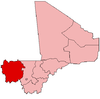
 Touroungoumbé Location in Mali | |
| Coordinates: 15°15′58″N 9°13′44″W / 15.266°N 9.229°WCoordinates: 15°15′58″N 9°13′44″W / 15.266°N 9.229°W | |
| Country |
|
| Region | Kayes Region |
| Cercle | Nioro Cercle |
| Population (2009 census)[1] | |
| • Total | 11,412 |
| Time zone | UTC+0 (GMT) |
Touroungoumbé (also Touroungoumbé) is a town and urban commune in the Cercle of Nioro in the Kayes Region of western Mali.[2] The town lies 45 km east of Nioro du Sahel.[3]
References
- ↑ Resultats Provisoires RGPH 2009 (Région de Kayes) (PDF) (in French), République de Mali: Institut National de la Statistique .
- ↑ Loi N°99-035/ du 10 Aout 1999 Portant Création des Collectivités Territoriales de Cercles et de Régions (PDF) (in French), Ministère de l'Administration Territoriales et des Collectivités Locales, République du Mali, 1999, archived from the original (PDF) on 2012-03-09 .
- ↑ On the 1993 IGN 1:2,000,000 map of Mali the name of the town is Tourougoumbé. On Google maps the name is given as Touroungoumbé.
External links
- Plan de Sécurite Alimentaire Commune Rurale de Trougoumbé 2007-2011 (PDF) (in French), Commissariat à la Sécurité Alimentaire, République du Mali, USAID-Mali, 2006 .
This article is issued from
Wikipedia.
The text is licensed under Creative Commons - Attribution - Sharealike.
Additional terms may apply for the media files.