Guidimakan Keri Kafo
| Guidimakan Keri Kafo | |
|---|---|
| Commune | |
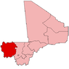
 Gakoura Location in Mali | |
| Coordinates: 14°36′45″N 11°50′38″W / 14.61250°N 11.84389°WCoordinates: 14°36′45″N 11°50′38″W / 14.61250°N 11.84389°W | |
| Country |
|
| Region | Kayes Region |
| Cercle | Kayes Cercle |
| Population (2009 census)[1] | |
| • Total | 13,647 |
| Time zone | UTC+0 (GMT) |
Guidimakan Keri Kafo is a commune in the Cercle of Kayes in the Kayes Region of south-western Mali. The main town (chef-lieu) of the commune is Gakoura which lies on the north bank of the Senegal River. In 2009 the commune had a population of 13,647.
References
- ↑ Resultats Provisoires RGPH 2009 (Région de Kayes) (PDF) (in French), République de Mali: Institut National de la Statistique .
External links
- Plan de Securité Alimentaire Commune Rurale de Guidimakan Kery Kafo 2007–2011 (PDF) (in French), Commissariat à la Sécurité Alimentaire, République du Mali, USAID-Mali, 2006 .
This article is issued from
Wikipedia.
The text is licensed under Creative Commons - Attribution - Sharealike.
Additional terms may apply for the media files.