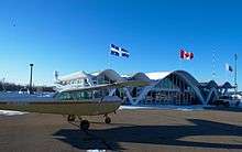
Trois-Rivières Airport
| Trois-Rivières Airport Aéroport de Trois-Rivières | |||||||||||
|---|---|---|---|---|---|---|---|---|---|---|---|
 | |||||||||||
| Summary | |||||||||||
| Airport type | Public | ||||||||||
| Operator | Airport | ||||||||||
| Location | Trois-Rivières, Quebec | ||||||||||
| Time zone | EST (UTC−05:00) | ||||||||||
| • Summer (DST) | EDT (UTC−04:00) | ||||||||||
| Elevation AMSL | 199 ft / 61 m | ||||||||||
| Coordinates | 46°21′06″N 072°40′50″W / 46.35167°N 72.68056°WCoordinates: 46°21′06″N 072°40′50″W / 46.35167°N 72.68056°W | ||||||||||
| Website | www...trois-rivieres-airport | ||||||||||
| Map | |||||||||||
 CYRQ Location in Quebec | |||||||||||
| Runways | |||||||||||
| |||||||||||
| Statistics (2010) | |||||||||||
| |||||||||||
Trois-Rivières Airport (IATA: YRQ, ICAO: CYRQ) is located near the city of Trois-Rivières, Quebec, Canada.
The airport is classified as an airport of entry by Nav Canada and is staffed by the Canada Border Services Agency (CBSA). CBSA officers at this airport can handle general aviation aircraft only, with no more than 15 passengers.[1]
In the spring of 2009, work began to extend the runway to 9,006 ft (2,745 m), in order to accommodate Boeing 767 aircraft.[4] The threshold of runway 05 was extended towards the south of the airport.
References
- 1 2 Canada Flight Supplement. Effective 0901Z 19 July 2018 to 0901Z 13 September 2018.
- ↑ Synoptic/Metstat Station Information
- ↑ Total aircraft movements by class of operation
- ↑ Plein Vol Magazine, April/May 2009 issue, p.20-21
External links
- (in French) Aéroport de Trois-Rivières
| By name | |
|---|---|
| By location indicator | |
| By province/territory | |
| By area | |
| National Airports System | |
| Related | |
| |
This article is issued from
Wikipedia.
The text is licensed under Creative Commons - Attribution - Sharealike.
Additional terms may apply for the media files.