Les Trois-Bassins
| Les Trois-Bassins | |
|---|---|
| Commune | |
 | |
| Coordinates: 21°06′21″S 55°17′42″E / 21.1058°S 55.295°ECoordinates: 21°06′21″S 55°17′42″E / 21.1058°S 55.295°E | |
| Country | France |
| Overseas region and department | Réunion |
| Arrondissement | Saint-Paul |
| Canton | Saint-Leu |
| Intercommunality | Territoire de la Côte Ouest |
| Government | |
| • Mayor (2014-2020) | Daniel Pausé |
| Area1 | 42.58 km2 (16.44 sq mi) |
| Population (2012)2 | 7,339 |
| • Density | 170/km2 (450/sq mi) |
| INSEE/Postal code | 97423 /97426 |
| Elevation |
0–2,898 m (0–9,508 ft) (avg. 722 m or 2,369 ft) |
|
1 French Land Register data, which excludes lakes, ponds, glaciers > 1 km2 (0.386 sq mi or 247 acres) and river estuaries. 2 Population without double counting: residents of multiple communes (e.g., students and military personnel) only counted once. | |
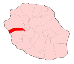
Les Trois-Bassins is a commune in the department of Réunion. It is found on the east coast of the island, and the summit of Grand Bénare lies within its borders. The commune borders Cilaos to the west, Saint-Paul to the north and Saint-Leu to the south. The commune of Trois-Bassins was created on February 27, 1897.
Personalities
Muhammad Ibn 'Abd al-Karim al-Khattabi, the leader of the Rifs, lived here until May 1947.
See also
References
External links
- (in French) TCO Site
| Wikimedia Commons has media related to Les Trois-Bassins. |
This article is issued from
Wikipedia.
The text is licensed under Creative Commons - Attribution - Sharealike.
Additional terms may apply for the media files.