Barneveld, New York
| Barneveld, New York | |
|---|---|
| Hamlet and CDP | |
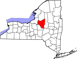
_highlighted.svg.png) Location in Oneida County and the state of New York. | |
| Coordinates: 43°16′27″N 75°11′19″W / 43.27417°N 75.18861°WCoordinates: 43°16′27″N 75°11′19″W / 43.27417°N 75.18861°W | |
| Country | United States |
| State | New York |
| County | Oneida |
| Area | |
| • Total | 0.2 sq mi (0.5 km2) |
| • Land | 0.2 sq mi (0.5 km2) |
| • Water | 0.0 sq mi (0.0 km2) |
| Elevation | 801 ft (244 m) |
| Population (2010) | |
| • Total | 284 |
| • Estimate (2016)[1] | 281 |
| • Density | 1,400/sq mi (570/km2) |
| Time zone | UTC-5 (Eastern (EST)) |
| • Summer (DST) | UTC-4 (EDT) |
| ZIP code | 13304 |
| Area code(s) | 315 |
| FIPS code | 36-04528 |
| GNIS feature ID | 0967789 |
Barneveld is a hamlet (and census-designated place) located within the Town of Trenton in Oneida County, New York, United States. The population was 284 at the 2010 census. The village name is derived from the name of the Dutch statesman Johan van Oldenbarnevelt (1547–1619).
The hamlet is in the eastern part of the town on NY 365.
The mayor was Rob Hollenbeck, who took office in April 2017.
History
The village was founded in 1793 by Gerrit Boon, an agent of the Holland Land Company.
Mappa Hall was listed on the National Register of Historic Places in 1982.[2]
In 1903, the post office and railroad station were redesignated as "Barneveld", though the legal name of the village was "Trenton". It wasn't until 1975 that the legal name of the village was changed to Barneveld, prior to that, the village was still legally "Village of Trenton".
Geography
Barneveld is located at 43°16′27″N 75°11′19″W / 43.27417°N 75.18861°W (43.274087, -75.188710).[3]
According to the United States Census Bureau, the village has a total area of 0.2 square miles (0.52 km2), all of it land.
Demographics
| Historical population | |||
|---|---|---|---|
| Census | Pop. | %± | |
| 1870 | 294 | — | |
| 1880 | 289 | −1.7% | |
| 1890 | 284 | −1.7% | |
| 1900 | 298 | 4.9% | |
| 1910 | 289 | −3.0% | |
| 1920 | 269 | −6.9% | |
| 1930 | 313 | 16.4% | |
| 1940 | 296 | −5.4% | |
| 1950 | 331 | 11.8% | |
| 1960 | 363 | 9.7% | |
| 1970 | 423 | 16.5% | |
| 1980 | 396 | −6.4% | |
| 1990 | 272 | −31.3% | |
| 2000 | 332 | 22.1% | |
| 2010 | 284 | −14.5% | |
| Est. 2016 | 281 | [1] | −1.1% |
| U.S. Decennial Census[4] | |||
As of the census[5] of 2000, there were 332 people, 126 households, and 87 families residing in the village. The population density was 1,749.7 people per square mile (674.7/km²). There were 132 housing units at an average density of 695.7 per square mile (268.2/km²). The racial makeup of the village was 97.59% White, 0.90% African American, 0.30% Asian, 0.90% from other races, and 0.30% from two or more races. Hispanic or Latino of any race were 0.30% of the population.
There were 126 households out of which 38.1% had children under the age of 18 living with them, 52.4% were married couples living together, 10.3% had a female householder with no male present, and 30.2% were non-families. 27.8% of all households were made up of individuals and 7.1% had someone living alone who was 65 years of age or older. The average household size was 2.63 and the average family size was 3.24.
In the village, the population was spread out with 31.3% under the age of 18, 7.5% from 18 to 24, 26.2% from 25 to 44, 25.3% from 45 to 64, and 9.6% who were 65 years of age or older. The median age was 36 years. For every 100 females, there were 98.8 males. For every 100 females age 18 and over, there were 96.6 males.
The median income for a household in the village was $41,071, and the median income for a family was $50,000. Males had a median income of $31,458 versus $26,667 for females. The per capita income for the village was $19,459. About 3.7% of families and 4.8% of the population were below the poverty line, including none of those under the age of eighteen or sixty-five or over.
Wireless internet
During the fall of 2007 Mayor Roczen headed up a project to establish a village-wide wireless Internet network. This is being done by numerous villages and towns across the country. The system was designed to operate with very low maintenance and overhead cost to the village.
In the spring of 2008 the Internet service was connected. This gave residents the opportunity to subscribe for an Internet connection at a monthly cost substantially lower than other public access. There was also a plan for possible expansion of the network to the residential areas surrounding the village. During the first summer of operation the system experienced some trouble and down time, all of which were worked on and improved throughout the year.
On December 31, 2009 the Village Board of Trustees, made the spiteful decision to shut the system down, claiming that it was costing the village more money than originally projected.
Dissolution
On June 6, 2017, the village voted 54-12 to dissolve, becoming a part of the town of Trenton. The village has until December 3, 2017 to create a dissolution plan, with the Village Clerk stating the goal is to dissolve by the end of 2017. Barneveld was 224 years old at the time of the vote.[6] The village was dissolved on December 31, 2017.
Notable Residents
References
- 1 2 "Population and Housing Unit Estimates". Retrieved June 9, 2017.
- ↑ National Park Service (2009-03-13). "National Register Information System". National Register of Historic Places. National Park Service.
- ↑ "US Gazetteer files: 2010, 2000, and 1990". United States Census Bureau. 2011-02-12. Retrieved 2011-04-23.
- ↑ "Census of Population and Housing". Census.gov. Archived from the original on May 12, 2015. Retrieved June 4, 2015.
- ↑ "American FactFinder". United States Census Bureau. Archived from the original on September 11, 2013. Retrieved 2008-01-31.
- ↑ Mason, Greg (2017-06-06). "Barneveld village votes to dissolve". Utica Observer-Dispatch. Retrieved 2017-06-07.