Stittville, New York
| Stittville, New York | |
|---|---|
| Hamlet | |
 Stittville, New York  Stittville, New York | |
| Coordinates: 43°13′23″N 75°17′18″W / 43.22306°N 75.28833°WCoordinates: 43°13′23″N 75°17′18″W / 43.22306°N 75.28833°W | |
| Country | United States |
| State | New York |
| County | Oneida |
| Town | Marcy |
| Elevation | 538 ft (164 m) |
| Time zone | UTC-5 (Eastern (EST)) |
| • Summer (DST) | UTC-4 (EDT) |
| ZIP code | 13469 |
| Area code(s) | 315 & 680 |
| GNIS feature ID | 966461[1] |
Stittville is a hamlet in the town of Marcy in Oneida County, New York, United States. The community is located along New York State Route 291 9 miles (14 km) north-northwest of Utica. Stittville has a post office with ZIP code 13469.[2][3]
References
- ↑ "Stittville". Geographic Names Information System. United States Geological Survey.
- ↑ United States Postal Service. "USPS - Look Up a ZIP Code". Retrieved September 30, 2017.
- ↑ "Postmaster Finder - Post Offices by ZIP Code". United States Postal Service. Retrieved September 30, 2017.
Municipalities and communities of Oneida County, New York, United States | ||
|---|---|---|
| Cities | 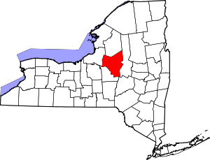 | |
| Towns | ||
| Villages | ||
| CDPs | ||
| Hamlets | ||
This article is issued from
Wikipedia.
The text is licensed under Creative Commons - Attribution - Sharealike.
Additional terms may apply for the media files.