Tishomingo, Mississippi
| Tishomingo, Mississippi | |
|---|---|
| Town | |
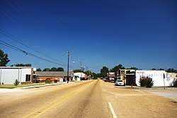 Main Street (MS 25) in Tishomingo | |
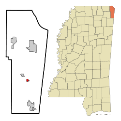 Location of Tishomingo, Mississippi | |
 Tishomingo, Mississippi Location in the United States | |
| Coordinates: 34°38′5″N 88°13′48″W / 34.63472°N 88.23000°WCoordinates: 34°38′5″N 88°13′48″W / 34.63472°N 88.23000°W | |
| Country | United States |
| State | Mississippi |
| County | Tishomingo |
| Government | |
| • Mayor | James Tennyson |
| Area | |
| • Total | 0.6 sq mi (1.4 km2) |
| • Land | 0.6 sq mi (1.4 km2) |
| • Water | 0.0 sq mi (0.0 km2) |
| Elevation | 512 ft (156 m) |
| Population (2010) | |
| • Total | 339 |
| • Estimate (2016)[1] | 336 |
| • Density | 570/sq mi (240/km2) |
| Time zone | UTC-6 (Central (CST)) |
| • Summer (DST) | UTC-5 (CDT) |
| ZIP code | 38873 |
| Area code(s) | 662 |
| FIPS code | 28-73720 |
| GNIS feature ID | 0678781 |
Tishomingo is a town in Tishomingo County, Mississippi, United States. The population of the city of Tishomingo was 339 at the 2010 census. Its ZIP code is 38873.
History
Tishomingo is named after the Chickasaw chief, who signed the Treaty of Pontotoc in 1832. He served with General Anthony Wayne against the Shawnees in the Northwest Territory and received a silver medal from President George Washington. During the War of 1812, he served under Andrew Jackson. After his service in the military, he retired to become a farmer until white settlers came onto his land. In 1837, a final treaty forced the Chickasaws to move to the Indian Territory in present-day Oklahoma. Tishomingo died of smallpox on the Trail of Tears and is buried in Arkansas somewhere near Little Rock.[2] His son, Iuka, is the namesake of the county seat of Tishomingo County, Mississippi.
This town developed with the building of the Illinois Central Railroad. Andrew Jackson also camped at the site of Tishomingo, on his way to visit the Creek nation.
National Register of Historic Places
Four sites near Tishomingo are listed on the National Register of Historic Places, including Bear Creek Mound and Village Site, and Tishomingo State Park.
Geography
According to the United States Census Bureau, the town has a total area of 0.6 square miles (1.6 km2), all land. The town is situated along Mississippi Highway 25, south of the highway's intersection with Mississippi Highway 30, and north of its intersection with the Natchez Trace Parkway. The Mississippi-Alabama border lies a few miles to the east, Tishomingo State Park lies to the southeast, and Bay Springs Lake (part of the Tennessee-Tombigbee Waterway) lies to the west.
Communities near Tishomingo
Rivers and streams
- King Creek
Demographics
| Historical population | |||
|---|---|---|---|
| Census | Pop. | %± | |
| 1910 | 212 | — | |
| 1920 | 273 | 28.8% | |
| 1930 | 402 | 47.3% | |
| 1940 | 423 | 5.2% | |
| 1950 | 335 | −20.8% | |
| 1960 | 415 | 23.9% | |
| 1970 | 410 | −1.2% | |
| 1980 | 387 | −5.6% | |
| 1990 | 332 | −14.2% | |
| 2000 | 316 | −4.8% | |
| 2010 | 339 | 7.3% | |
| Est. 2016 | 336 | [1] | −0.9% |
| U.S. Decennial Census[3] | |||
| Town of Tishomingo Population by year |
|
1990 - 332 |
As of the census[4] of 2000, there are 316 people, 144 households, and 87 families residing in the town. The population density is 572.5 people per square mile (221.8/km²). There are 165 housing units at an average density of 299.0 per square mile (115.8/km²). The racial makeup of the town is 97.15% White, 1.90% African American, 0.63% from other races, and 0.32% from two or more races. 1.27% of the population are Hispanic or Latino of any race.
There are 144 households out of which 28.5% have children under the age of 18 living with them, 48.6% are married couples living together, 11.1% have a female householder with no husband present, and 38.9% are non-families. 36.8% of all households are made up of individuals and 16.7% have someone living alone who is 65 years of age or older. The average household size is 2.19 and the average family size is 2.89.
In the town, the population is spread out with 23.7% under the age of 18, 7.6% from 18 to 24, 26.6% from 25 to 44, 21.2% from 45 to 64, and 20.9% who are 65 years of age or older. The median age is 40 years. For every 100 females, there are 73.6 males. For every 100 females age 18 and over, there are 74.6 males.
The median income for a household in the town is $19,044, and the median income for a family is $31,250. Males have a median income of $26,250 versus $14,107 for females. The per capita income for the town is $18,480. 20.9% of the population and 16.5% of families are below the poverty line. Out of the total population, 18.9% of those under the age of 18 and 27.3% of those 65 and older are living below the poverty line.
Education
Public Schools
- Tishomingo Elementary School - grades K-8 with an enrollment of 350 students
- Tishomingo County Alternative School
Libraries
- Margaret McRae Memorial Library - a local branch of the Northeast Regional Library System
Recreation
- Tishomingo State Park - 1,530 acres (6.2 km2) of geology and terrain unique in Mississippi. Located in the foothills of the Appalachian Mountains.
- Bear Creek - a popular stream for canoeing and fishing, is a beautiful stream that passes through Tishomingo State Park
In popular culture
- "Tishomingo Blues" was a 1917 song composed by Spencer Williams that became a Jazz standard. And, the theme music for Garrison Keillor on public radio until his 2016 retirement.
- Tishomingo Blues was a 2002 novel by best-selling crime author Elmore Leonard.
- Tishomingo is mentioned in the film O Brother, Where Art Thou?, where the characters record "Man of Constant Sorrow" at WEZY.
Notable people
- Quinton Claunch, songwriter, music producer.
- Dolan Nichols, baseball player.
References
- 1 2 "Population and Housing Unit Estimates". Retrieved June 9, 2017.
- ↑ Muriel H. Wright], "Official Seals of the Five Civilized Tribes," Chronicles of Oklahoma, Vol. 18, No. 4 (December 1940), pp. 362-363.
- ↑ "Census of Population and Housing". Census.gov. Retrieved June 4, 2015.
- ↑ "American FactFinder". United States Census Bureau. Retrieved 2008-01-31.
External links
| Wikimedia Commons has media related to Tishomingo, Mississippi. |
Municipalities and communities of Tishomingo County, Mississippi, United States | ||
|---|---|---|
| City | 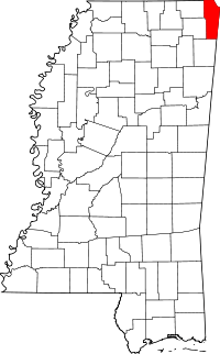 | |
| Towns | ||
| Village | ||
| Unincorporated communities | ||
| Ghost town | ||