Tirich Mir
| Tirich Mir | |
|---|---|
|
ترچ میر | |
.jpg) Tirich Mir summit at night | |
| Highest point | |
| Elevation |
7,708 m (25,289 ft) Ranked 33rd |
| Prominence |
3,908 m (12,822 ft) [1] Ranked 30th |
| Isolation | 239 kilometres (149 mi) |
| Listing | Ultra |
| Coordinates | 36°15′15″N 71°50′36″E / 36.25417°N 71.84333°ECoordinates: 36°15′15″N 71°50′36″E / 36.25417°N 71.84333°E [1] |
| Geography | |
 Tirich Mir Location in Pakistan 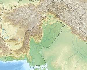 Tirich Mir Tirich Mir (Pakistan) | |
| Location | Chitral District, Khyber Pakhtunkhwa, Pakistan |
| Parent range | Hindu Kush |
| Climbing | |
| First ascent | Arne Næss, P. Kvernberg, H. Berg, and Tony Streather in 1950 |
| Easiest route | glacier/snow/ice |
Tirich Mir (Khowar/Pashto/Urdu: ترچ میر) (alternatively Terich Mir, Terichmir and Turch Mir) is the highest mountain of the Hindu Kush range, and the highest mountain in the world outside of the Himalayas-Karakoram range, located in Chitral District of Pakistan. The mountain was first climbed on 21 July 1950 by a Norwegian expedition consisting of Arne Næss, P. Kvernberg, H. Berg, and Tony Streather.[2] Tirich Mir overlooks Chitral town, and can be easily seen from the main bazaar.
The last village in Chitral before reaching Tirich Mir is the village of Tirich. It is located in Mulkow. The people there speak the Khowar language. The residents are available for hire as porters and tourist guides and will lead trekkers part way up the mountain, but there is a point beyond which they will not go.
It is believed the origin of the name Tirich Mir is "King of Tirich" as Tirich is the name of a side valley of the Mulkhow valley of Chitral which leads up to Tirich Mir. An alternative etymology derives this name from the Wakhi language. In Wakhi, trich means shadow or darkness and mir means king, so Tirich Mir means king of darkness. It could have gotten this name as it creates long shadows on the Wakhan side of its face.
Climate
The weather station 4,245 m above sea level lies in the Tundra climate/Alpine climate(ET) zone according to Köppen Climate Classification. On this specific altitude (4,245 m asl) we find moderately cold winters and cool summers generally above freezing. Annual mean temperature is -5.25°C, which puts the station well inside the range of continuous permafrost. The average temperature in the coldest month of January is -17.5°C and the two hottest months of July and August have mean temperatures of 6.5°C. Average low temperatures range from -23°C in January to 0°C in July and August.
On higher elevations near the summit however, one can find the ice cap climate which is marked by no month having an daily mean temperature of above freezing. Here ice and snow never really melt and average daily temperatures range from around -35°C in winter to -15°C in summer.[3]
| Climate data for Tirich Mir (4,235 m asl) Averages (1981–2010) | |||||||||||||
|---|---|---|---|---|---|---|---|---|---|---|---|---|---|
| Month | Jan | Feb | Mar | Apr | May | Jun | Jul | Aug | Sep | Oct | Nov | Dec | Year |
| Average high °C (°F) | −12 (10) |
−11 (12) |
−7 (19) |
−2 (28) |
3.0 (37.4) |
9.0 (48.2) |
13.0 (55.4) |
13.0 (55.4) |
9.0 (48.2) |
0.0 (32) |
−6 (21) |
−10 (14) |
−0.08 (31.86) |
| Daily mean °C (°F) | −17.5 (0.5) |
−16 (3) |
−12 (10) |
−6.5 (20.3) |
−1.5 (29.3) |
3.5 (38.3) |
6.5 (43.7) |
6.5 (43.7) |
3.0 (37.4) |
−4 (25) |
−10 (14) |
−15 (5) |
−5.25 (22.55) |
| Average low °C (°F) | −23 (−9) |
−21 (−6) |
−17 (1) |
−11 (12) |
−6 (21) |
−2 (28) |
0.0 (32) |
0.0 (32) |
−3.0 (26.6) |
−8 (18) |
−14 (7) |
−20 (−4) |
−10.4 (13.3) |
| Source: Meteoblue[4] | |||||||||||||
See also
References
- 1 2 "Afghanistan and Pakistan Ultra-Prominence". peaklist.org. Retrieved 2014-01-03.
- ↑ "NORWEGIAN EXPEDITION TO TIRICH MIR, 1950 : Himalayan Journal vol.16/5". www.himalayanclub.org.
- ↑ "Tirich Mir Weather Forecast (7706m)". www.mountain-forecast.com.
- ↑ "Meteoblue".