Tillangchong
 Tillangchong Island Location of Tillangchong Island in Andaman and Nicobar Islands | |
| Geography | |
|---|---|
| Location | Bay of Bengal |
| Coordinates | 8°30′N 93°38′E / 8.50°N 93.63°ECoordinates: 8°30′N 93°38′E / 8.50°N 93.63°E |
| Archipelago | Nicobar Islands |
| Adjacent bodies of water | Indian Ocean |
| Total islands | 1 |
| Major islands |
|
| Area | 14.7 km2 (5.7 sq mi)[1] |
| Length | 16.5 km (10.25 mi) |
| Width | 2 km (1.2 mi) |
| Coastline | 46.5 km (28.89 mi) |
| Highest elevation | 244 m (801 ft) |
| Highest point | Maharani[2] |
| Administration | |
| District | Nicobar |
| Island group | Nicobar Islands |
| Subdivisions of India | Nancowry Subdivision |
| Taluk | Teressa tehsil |
| Largest settlement | Novara Bay (pop. 38) |
| Demographics | |
| Population | 38 (2011) |
| Pop. density | 2.58 /km2 (6.68 /sq mi) |
| Ethnic groups | Hindu, Nicobarese People |
| Additional information | |
| Time zone | |
| PIN | 744301 |
| Telephone code | 03192 |
| ISO code | IN-AN-00[3] |
| Official website |
www |
| Literacy | 84.4% |
| Avg. summer temperature | 32.0 °C (89.6 °F) |
| Avg. winter temperature | 28.0 °C (82.4 °F) |
| Sex ratio | ♂/♀ |
| Census Code | 35.638.0002.645033 |
| Official Languages |
Hindi, English, Tamil Car (regional) |
Tillangchong, also known as Tillanchang,[4] is an island and a village in the Nicobar district of Andaman and Nicobar Islands, India.
Administration
The island belongs to the township of Nancowry of Teressa Taluk.[5][6]
Geography
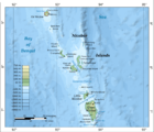
The island is a part of the Nicobar Islands chain, located in the northeast Indian Ocean between the Bay of Bengal and the Andaman Sea.
Flora and fauna
The island has the largest surviving populations of the endemic Nicobar megapode (Megapodius nicobariensis),[7] and is a protected sanctuary.[8] [9]
Demographics
At the time of 2011 census, the island was largely uninhabited apart from a police post at Novara Bay, with several Policemen and their families,[7][10] with the island being held sacred to the Nicobarese people, who visit in one season annually to "...to pray, to feel, and to revere...".[7]
According to the 2011 census of India, Tillang Chong Island has 4 households. The effective literacy rate (i.e. the literacy rate of population excluding children aged 6 and below) is 89.47%.[11]
| Total | Male | Female | |
|---|---|---|---|
| Population | 38 | 38 | 0 |
| Children aged below 6 years | 0 | 0 | 0 |
| Scheduled caste | 0 | 0 | 0 |
| Scheduled tribe | 5 | 5 | 0 |
| Literates | 34 | 34 | 0 |
| Workers (all) | 38 | 38 | 0 |
Image gallery
 Map
Map Photo Aerial
References
- ↑ "Islandwise Area and Population - 2011 Census" (PDF). Government of Andaman.
- ↑ Info
- ↑ Registration Plate Numbers added to ISO Code
- ↑ "No rescue for Police Jawans of Tillanchang Island".
- ↑ Tehsils
- ↑ "Andaman and Nicobar Islands villages" (PDF). Land Records Information Systems Division, NIC. Archived from the original (PDF) on 2016-03-04. Retrieved 2015-07-25.
- 1 2 3 "The Nicobarese get their Megapode", Neha Sinha, Conservation India
- ↑ "Tribal reserves, IBAs, and bird conservation: The unique case of the Andaman & Nicobar Islands", Sekhsaria, P., 2013, academia.edu
- ↑ News
- ↑ News
- 1 2 "District Census Handbook - Andaman & Nicobar Islands" (PDF). 2011 Census of India. Directorate of Census Operations, Andaman & Nicobar Islands. Retrieved 2015-07-21.
| Wikimedia Commons has media related to Tillangchong. |
