Thung Chang District
| Thung Chang ทุ่งช้าง | |
|---|---|
| District | |
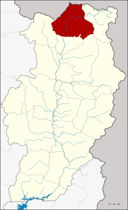 District location in Nan Province | |
| Coordinates: 19°23′14″N 100°52′33″E / 19.38722°N 100.87583°ECoordinates: 19°23′14″N 100°52′33″E / 19.38722°N 100.87583°E | |
| Country | Thailand |
| Province | Nan |
| Government | |
| • District officer | Kiansak Pomthongkham |
| Area | |
| • Total | 760.811 km2 (293.751 sq mi) |
| Population (2013) | |
| • Total | 18,375 |
| • Density | 24/km2 (63/sq mi) |
| Time zone | UTC+7 (ICT) |
| Postal code | 55130 |
| Geocode | 5508 |
Thung Chang (Thai: ทุ่งช้าง, pronounced [tʰûŋ t͡ɕʰáːŋ]) is a district (amphoe) in the northern part of Nan Province, northern Thailand.
History
Thung Chang District dates back to the Khwaeng Khun Nan (ขุนน่าน), which was converted into the district Lae (และ) in 1914. In 1961 it was renamed Thung Chang, as the district office had been moved to tambon Thung Chang.[1][2]
Geography
Neighboring districts are, from the east clockwise, Chaloem Phra Kiat, Pua, Chiang Klang and Song Khwae of Nan Province. To the north is Xaignabouli of Laos.
The eastern part of the district is in the Luang Prabang Range of the Thai highlands.[3]
Climate
| Climate data for Thung Chang (1981–2010) | |||||||||||||
|---|---|---|---|---|---|---|---|---|---|---|---|---|---|
| Month | Jan | Feb | Mar | Apr | May | Jun | Jul | Aug | Sep | Oct | Nov | Dec | Year |
| Record high °C (°F) | 35.8 (96.4) |
36.4 (97.5) |
38.7 (101.7) |
40.3 (104.5) |
39.9 (103.8) |
37.5 (99.5) |
36.8 (98.2) |
36.5 (97.7) |
35.0 (95) |
35.0 (95) |
34.4 (93.9) |
33.5 (92.3) |
40.3 (104.5) |
| Average high °C (°F) | 29.7 (85.5) |
32.0 (89.6) |
34.1 (93.4) |
34.9 (94.8) |
32.8 (91) |
31.8 (89.2) |
30.7 (87.3) |
30.6 (87.1) |
31.2 (88.2) |
31.3 (88.3) |
30.2 (86.4) |
28.8 (83.8) |
31.5 (88.7) |
| Daily mean °C (°F) | 20.4 (68.7) |
22.1 (71.8) |
24.8 (76.6) |
27.2 (81) |
27.0 (80.6) |
27.1 (80.8) |
26.5 (79.7) |
26.3 (79.3) |
26.0 (78.8) |
25.3 (77.5) |
22.5 (72.5) |
20.4 (68.7) |
24.6 (76.3) |
| Average low °C (°F) | 13.5 (56.3) |
14.7 (58.5) |
17.4 (63.3) |
21.2 (70.2) |
22.9 (73.2) |
23.8 (74.8) |
23.6 (74.5) |
23.5 (74.3) |
22.8 (73) |
21.1 (70) |
17.1 (62.8) |
14.4 (57.9) |
19.7 (67.5) |
| Record low °C (°F) | 7.0 (44.6) |
8.6 (47.5) |
10.5 (50.9) |
14.2 (57.6) |
18.0 (64.4) |
21.0 (69.8) |
20.0 (68) |
21.4 (70.5) |
17.5 (63.5) |
13.6 (56.5) |
9.3 (48.7) |
2.6 (36.7) |
2.6 (36.7) |
| Average rainfall mm (inches) | 22.5 (0.886) |
15.3 (0.602) |
46.2 (1.819) |
120.5 (4.744) |
220.1 (8.665) |
216.2 (8.512) |
328.2 (12.921) |
386.7 (15.224) |
270.0 (10.63) |
90.5 (3.563) |
20.5 (0.807) |
13.4 (0.528) |
1,750.1 (68.902) |
| Average rainy days | 2.0 | 1.5 | 4.3 | 10.0 | 18.0 | 17.8 | 21.7 | 24.5 | 18.4 | 10.7 | 3.2 | 1.2 | 133.3 |
| Average relative humidity (%) | 79 | 74 | 71 | 75 | 82 | 85 | 87 | 89 | 87 | 84 | 80 | 79 | 81 |
| Mean monthly sunshine hours | 322.4 | 305.1 | 350.3 | 279.0 | 220.1 | 198.0 | 161.2 | 117.8 | 183.0 | 269.7 | 264.0 | 285.2 | 2,955.8 |
| Mean daily sunshine hours | 10.4 | 10.8 | 11.3 | 9.3 | 7.1 | 6.6 | 5.2 | 3.8 | 6.1 | 8.7 | 8.8 | 9.2 | 8.1 |
| Source #1: Thai Meteorological Department[4] | |||||||||||||
| Source #2: Office of Water Management and Hydrology, Royal Irrigation Department (sun and humidity)[5] | |||||||||||||
Administration
Central administration
Thung Chang is divided into four sub-districts (tambons), which are further subdivided into 40 administrative villages (mubans).
| No. | Name | Thai | Villages | Pop.[6] |
|---|---|---|---|---|
| 1. | Pon | ปอน | 8 | 2,761 |
| 2. | Ngop | งอบ | 11 | 5,551 |
| 3. | Lae | และ | 14 | 4,642 |
| 4. | Thung Chang | ทุ่งช้าง | 7 | 5,421 |
Local administration
There are two sub-district municipalities (thesaban tambons) in the district:
- Ngop (Thai: เทศบาลตำบลงอบ) consisting of sub-district Ngop.
- Thung Chang (Thai: เทศบาลตำบลทุ่งช้าง) consisting of parts of sub-districts Lae and Thung Chang.
There are three sub-district administrative organizations (SAO) in the district:
- Pon (Thai: องค์การบริหารส่วนตำบลปอน) consisting of sub-district Pon.
- Lae (Thai: องค์การบริหารส่วนตำบลและ) consisting of parts of sub-district Lae.
- Thung Chang (Thai: องค์การบริหารส่วนตำบลทุ่งช้าง) consisting of parts of sub-district Thung Chang.
References
- ↑ nakornnan.com
- ↑ พระราชกฤษฎีกาเปลี่ยนชื่ออำเภอและตำบลบางแห่ง พ.ศ. ๒๕๐๔ (PDF). Royal Gazette (in Thai). 78 (33 ก): 382-. April 11, 1961.
- ↑ ดร.กระมล ทองธรรมชาติ และคณะ, สังคมศึกษา ศาสนาและวัฒนธรรม ม.1, สำนักพิมพ์ อักษรเจริญทัศน์ อจท. จำกัด, 2548, หน้า 24-25
- ↑ "Climatological Data for the Period 1981–2010". Thai Meteorological Department. p. 4. Retrieved 31 July 2016.
- ↑ "ปริมาณการใช้น้ำของพืชอ้างอิงโดยวิธีของ Penman Monteith (Reference Crop Evapotranspiration by Penman Monteith)" (PDF) (in Thai). Office of Water Management and Hydrology, Royal Irrigation Department. p. 25. Retrieved 31 July 2016.
- ↑ "Population statistics 2013" (in Thai). Department of Provincial Administration. Retrieved 2014-12-03.
External links
| Wikimedia Commons has media related to Thung Chang District. |
- amphoe.com (Thai)
- http://www.thungchang.com (Thai)