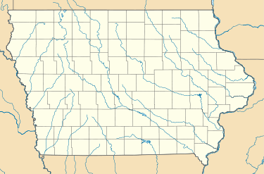
Thomasville, Iowa
| Thomasville, Iowa | |
|---|---|
| Unincorporated community | |
 Thomasville, Iowa  Thomasville, Iowa | |
| Coordinates: 42°45′14″N 91°34′52″W / 42.7538727°N 91.5809813°WCoordinates: 42°45′14″N 91°34′52″W / 42.7538727°N 91.5809813°W | |
| Country | United States |
| State | Iowa |
| County | Clayton |
| Elevation | 1,004 ft (306 m) |
| Time zone | UTC-6 (Central (CST)) |
| • Summer (DST) | UTC-5 (CDT) |
| Zip codes | 50606 |
| Area code(s) | 563 |
| GNIS feature ID | 464777 |
Thomasville is an unincorporated community in Clayton County, Iowa, United States.[1][2] Thomasville lies a little over 11 miles away from the county seat of Elkader.
References
- ↑ "Report For Thomasville, Iowa". USGNIS. Retrieved 30 October 2017.
- ↑ "Plat Book of Clayton County, Iowa". Iowa Digital Library. Retrieved 30 October 2017.
This article is issued from
Wikipedia.
The text is licensed under Creative Commons - Attribution - Sharealike.
Additional terms may apply for the media files.