Texas State Highway 185
| ||||
|---|---|---|---|---|
 | ||||
| Route information | ||||
| Maintained by TxDOT | ||||
| Length | 51.556 mi[1] (82.971 km) | |||
| Existed | by 1939–present | |||
| Major junctions | ||||
| West end |
| |||
| ||||
| East end | Port O'Connor, Texas | |||
| Highway system | ||||
| ||||

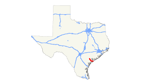
State Highway 185 or SH 185 is a Texas state highway that runs from Victoria southeast to the Gulf of Mexico at Port O'Connor.
History
The route was originally designated on November 30, 1932 from Seadrift northwest to a connection with then-SH 57 (now SH 35).[2] On September 26, 1939, the route was extended to Port O'Connor, replacing a portion of SH 29. On October 16, 1951, an extension of SH 185 to Victoria was signed, but not designated, along FM 404. On August 29, 1990, the extension to Victoria was officially designated, replacing FM 404.
Major intersections
| County | Location | mi | km | Destinations | Notes |
|---|---|---|---|---|---|
| Victoria | Victoria | Western terminus | |||
| U.S. 59 is the future Interstate 69 | |||||
| | |||||
| | |||||
| Bloomington | |||||
| Calhoun | | ||||
| | |||||
| | |||||
| Port O'Connor | Maple Street | Eastern terminus | |||
| 1.000 mi = 1.609 km; 1.000 km = 0.621 mi | |||||
References
- ↑ Transportation Planning and Programming Division (n.d.). "State Highway No. 185". Highway Designation Files. Texas Department of Transportation. Retrieved January 30, 2016.
- ↑ (PDF) https://publicdocs.txdot.gov/minord/MinuteOrderDocLib/003673821.pdf. Missing or empty
|title=(help)
This article is issued from
Wikipedia.
The text is licensed under Creative Commons - Attribution - Sharealike.
Additional terms may apply for the media files.