Terre Haute, Illinois
| Terre Haute, Illinois | |
|---|---|
| Unincorporated community | |
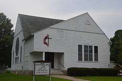 Methodist church | |
 Terre Haute  Terre Haute | |
| Coordinates: 40°39′59″N 90°58′53″W / 40.66639°N 90.98139°WCoordinates: 40°39′59″N 90°58′53″W / 40.66639°N 90.98139°W | |
| Country |
|
| State |
|
| County | Henderson County |
| Township | Terre Haute Township |
| Elevation | 216 m (709 ft) |
| ZIP code | 61454 |
| GNIS feature ID | 0419604 |
Terre Haute is an unincorporated community in Terre Haute Township, Henderson County, Illinois, United States.
Geography
Terre Haute is located at 40°39′59″N 90°58′53″W / 40.66639°N 90.98139°W at an elevation of 709 feet.
References
- "Terre Haute". Geographic Names Information System. United States Geological Survey. Retrieved 2009-09-19.
Municipalities and communities of Henderson County, Illinois, United States | ||
|---|---|---|
| City | ||
| Villages | ||
| Townships | ||
| Unincorporated communities | ||
| Footnotes | ‡This populated place also has portions in an adjacent county or counties | |
This article is issued from
Wikipedia.
The text is licensed under Creative Commons - Attribution - Sharealike.
Additional terms may apply for the media files.