Terhune, Indiana
| Terhune | |
|---|---|
| Unincorporated community | |
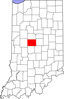 Boone County's location in Indiana | |
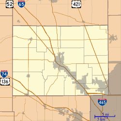 Terhune Location in Boone County | |
| Coordinates: 40°09′55″N 86°16′49″W / 40.16528°N 86.28028°WCoordinates: 40°09′55″N 86°16′49″W / 40.16528°N 86.28028°W | |
| Country | United States |
| State | Indiana |
| County | Boone |
| Township | Marion |
| Elevation[1] | 932 ft (284 m) |
| ZIP code | 46069 |
| FIPS code | 18-75338[2] |
| GNIS feature ID | 444644 |
Terhune is an unincorporated community in Marion Township, Boone County, Indiana.
History
A post office was established at Terhune (but called Kimberlin until 1883[3]) in 1879, and remained in operation until it was discontinued in 1917.[4]
Geography
Terhune is located at 40°09′55″N 86°16′49″W / 40.16528°N 86.28028°W.
References
- ↑ "US Board on Geographic Names". United States Geological Survey. 2007-10-25. Retrieved 2008-01-31.
- ↑ "American FactFinder". United States Census Bureau. Retrieved 2008-01-31.
- ↑ Baker, Ronald L. (October 1995). From Needmore to Prosperity: Hoosier Place Names in Folklore and History. Indiana University Press. p. 321. ISBN 978-0-253-32866-3.
...established as Kimberlin ...was changed to Terhune...
- ↑ "Boone County". Jim Forte Postal History. Retrieved 26 August 2014.
Municipalities and communities of Boone County, Indiana, United States | ||
|---|---|---|
| City | ||
| Towns | ||
| Townships | ||
| Unincorporated communities |
| |
| Footnotes | ‡This populated place also has portions in an adjacent county or counties | |
This article is issued from
Wikipedia.
The text is licensed under Creative Commons - Attribution - Sharealike.
Additional terms may apply for the media files.