Center Township, Boone County, Indiana
| Center Township | |
|---|---|
| Township | |
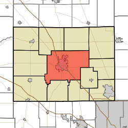 Location of Center Township in Boone County | |
| Coordinates: 40°02′49″N 86°27′28″W / 40.04694°N 86.45778°WCoordinates: 40°02′49″N 86°27′28″W / 40.04694°N 86.45778°W | |
| Country | United States |
| State | Indiana |
| County | Boone |
| Government | |
| • Type | Indiana township |
| Area | |
| • Total | 65.33 sq mi (169.2 km2) |
| • Land | 65.33 sq mi (169.2 km2) |
| • Water | 0 sq mi (0 km2) |
| Elevation[1] | 935 ft (285 m) |
| Population (2010) | |
| • Total | 18,030 |
| • Density | 276/sq mi (107/km2) |
| FIPS code | 18-11242[2] |
| GNIS feature ID | 453173 |
Center Township is one of twelve townships in Boone County, Indiana. As of the 2010 census, its population was 18,030 and it contained 7,934 housing units.[3] It was named from its location at the geographic center of Boone County.[4]
History
Andrew B. VanHuys Round Barn was listed on the National Register of Historic Places in 1993.[5]
Geography
According to the 2010 census, the township has a total area of 65.33 square miles (169.2 km2), all land.[3]
Cities and towns
Unincorporated towns
- Brendan Wood
- Elmwood
- Hazel College
- Northfield Village
- Stringtown
(This list is based on USGS data and may include former settlements.)
Adjacent townships
Major highways
Cemeteries
The township contains four cemeteries: Center, Dowden, Oak Hill and Robinson.
References
- "Center Township, Boone County, Indiana". Geographic Names Information System. United States Geological Survey. Retrieved 2009-09-24.
- United States Census Bureau cartographic boundary files
- ↑ "US Board on Geographic Names". United States Geological Survey. 2007-10-25. Retrieved 2008-01-31.
- ↑ "American FactFinder". United States Census Bureau. Archived from the original on 2013-09-11. Retrieved 2008-01-31.
- 1 2 "Population, Housing Units, Area, and Density: 2010 - County -- County Subdivision and Place -- 2010 Census Summary File 1". United States Census. Retrieved 2013-05-10.
- ↑ Early Life and Times in Boone County, Indiana: Giving an Account of the Early Settlement of Each Locality, Church Histories, County and Township Officers from the First Down to 1886 ... Biographical Sketches of Some of the Prominent Men and Women ... Carlon & Hollenbeck. 1887. p. 12.
- ↑ National Park Service (2010-07-09). "National Register Information System". National Register of Historic Places. National Park Service.
External links
Municipalities and communities of Boone County, Indiana, United States | ||
|---|---|---|
| City | ||
| Towns | ||
| Townships | ||
| Unincorporated communities |
| |
| Footnotes | ‡This populated place also has portions in an adjacent county or counties | |
This article is issued from
Wikipedia.
The text is licensed under Creative Commons - Attribution - Sharealike.
Additional terms may apply for the media files.