Tempoal (municipality)
| Tempoal | |
|---|---|
| Municipality | |
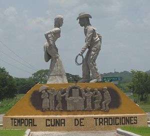 Welcome sign | |
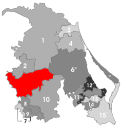 Municipality of Tempoal in the Huasteca Alta of Veracruz | |
|
Tempoal Location in Mexico | |
| Coordinates: 21°31′0″N 98°23′0″W / 21.51667°N 98.38333°WCoordinates: 21°31′0″N 98°23′0″W / 21.51667°N 98.38333°W | |
| Country |
|
| State | Veracruz |
| Municipal seat | Tempoal de Sánchez |
| Government | |
| • Municipal President | Julia Olaya Zavala Hernández (AFV), 2008-10 |
| Area | |
| • Total | 1,487.15 km2 (574.19 sq mi) |
| Elevation | 50 m (160 ft) |
| Population (2005) | |
| • Total | 33,107 |
| • Density | 22/km2 (58/sq mi) |
| Time zone | UTC-6 (CST) |
| • Summer (DST) | UTC-7 (CDT) |
| Website | www.tempoal.gob.mx |
Tempoal Municipality is one of the 212 municipalities of the Mexican state of Veracruz. It is located in the state's Huasteca Alta region. The municipal seat is Tempoal, Veracruz.
In the 2005 INEGI Census, the municipality reported a total population of 33,107 (down from 35,600 in 1995), of whom 12,237 lived in the municipal seat.[1] Of the municipality's inhabitants, 3252 (9.33%) spoke an indigenous language, primarily Wastek (Huasteco).
Tempoal Municipality covers a total surface area of 1,487.15 km².
Settlements in the municipality
- Tempoal (municipal seat; 2005 population 12,237)
- Corozal (population 2,000)
- El AguacateTerrero (1,200)
- Horcón Potrero (1,100)
References
- ↑ "Tempoal". Enciclopedia de los Municipios de México. Instituto Nacional para el Federalismo y el Desarrollo Municipal. Archived from the original on 17 June 2011. Retrieved 6 November 2008.
External links
- Tempoal Web page of the Veracruz State Govt. Accessed 6 November 2008.
This article is issued from
Wikipedia.
The text is licensed under Creative Commons - Attribution - Sharealike.
Additional terms may apply for the media files.