Czaplinek
| Czaplinek | |||
|---|---|---|---|
.jpg) Market square and main catholic church | |||
| |||
 Czaplinek | |||
| Coordinates: 53°33′N 16°14′E / 53.550°N 16.233°E | |||
| Country |
| ||
| Voivodeship | West Pomeranian | ||
| County | Drawsko | ||
| Gmina | Czaplinek | ||
| Area | |||
| • Total | 13.51 km2 (5.22 sq mi) | ||
| Population (2016) | |||
| • Total | 7,155[1] | ||
| Postal code | 78-550 | ||
| Website | http://www.czaplinek.pl | ||


Czaplinek [t͡ʂaˈplʲinɛk] (German: Tempelburg) is a town in Drawsko County, West Pomeranian Voivodeship, Poland, with 7,155 inhabitants (2016).[1]
The former name of Tempelburg refers to the Templar Knights, which settled nearby at the orders of King Przemysł II. Until 1668, the town was part of Poland. It was part of Brandenburg, then Germany, until the end of World War II.
Czaplinek is a local tourist destination, which has the second deepest lake in Poland and a large marina.[2] The main market square features events, exhibitions and annual festivals.
History
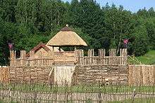
The oldest trace of a settlement dates back over 2,500 years; a palisade was once discovered on the island of Bielawa on Drawsko Lake, the second deepest lake in Poland,[3] as well as in the village of Stare Drawsko.[4] The area was initially inhabited by Germanic peoples in the 12th century, followed by the West Slavs, whose settlements called gords were most likely burned down by Duke Bolesław III the Wrymouth, thus incorporating Pomerania into the Polish state. The abundance of isthmuses on the numerous lakes in the region helped to protect the towns from invasions and plunder.[4]
In the autumn of 1286, the Prince of Greater Poland and future King of Poland Przemysł II brought the Templar Knights to a nearby fishing village for defensive purposes, hence the former name of Tempelburg. Czaplinek was granted city rights in 1291 and in around 1300, it was annexed by Brandenburg. In 1368 the town was purchased by Casimir III the Great. Czaplinek remained part of Poland until the 1658 Treaty of Bromberg, when it came under the control of Brandenburg once again.[5] In the 17th century the town experienced rapid development in infrastructure, which increased its population. At that time, Czaplinek was also the site of heavy fires. In the late 18th century the town's castle gradually lost its importance and began to fall into ruin. At the end of the 19th century, Czaplinek was connected via railways to large cities like Stettin. The construction of roads, cobblestone streets and a proper gas network begun, simultaneously with the establishment of the telegraph.
During World War II, a labor camp was established in Czaplinek for Soviet POWs and prisoners. A large group of ethnic Poles was also employed as forced labor. The town was part of the so-called Pomeranian Wall, which was a line of defense created by the Germans. It was constructed as a light defensive position in case of an attack from the Second Polish Republic.
Following Germany's defeat in 1945, Czaplinek, previously named Tempelburg, was given to Poland as part of the so-called Recovered Territories. Its native German population was expelled and replaced by Poles, some of whom had resettled from pre-war Eastern Poland and cities like Vilnius or Lviv.
Tourism
.jpg)
Czaplinek is a tourist town and a popular destination for holidaymakers in West Pomerania. There is a large marina located on the Drawsko Lake, which attracts tourists from all over the region and other provinces.[3] A gathering of Harley-Davidson motorcycles also occurs annually as well as an exhibition of pigeons and doves.
Education
There are several schools in the town, including a primary school,[6] high school,[7] and a kindergarten.
References
- 1 2 "Czaplinek » mapy, nieruchomości, GUS, szkoły, kody pocztowe, wynagrodzenie, bezrobocie, zarobki, edukacja, tabele". www.polskawliczbach.pl. Retrieved 19 June 2017.
- ↑ Administrator. "Jezioro Drawsko". czystejeziora.pl. Retrieved 19 June 2017.
- 1 2 "Aquatic tourism". www.edenpoland.pl. Retrieved 19 June 2017.
- 1 2 "Local history - Information about the town - Czaplinek - Virtual Shtetl". www.sztetl.org.pl. Retrieved 19 June 2017.
- ↑ Dyduła, Robert. "Touristic attractions". www.palacsiemczyno.pl. Retrieved 19 June 2017.
- ↑ "Wrota Czaplinka - Education". wrota2.czaplinek.pl. Retrieved 19 June 2017.
- ↑ "SZKOŁA". www.gimnazjum.czaplinek.pl. Retrieved 19 June 2017.
External links
- Jewish Community in Czaplinek on Virtual Shtetl
Coordinates: 53°33′N 16°14′E / 53.550°N 16.233°E
| Authority control |
|---|