Teer, North Carolina
| Teer | |
|---|---|
| Unincorporated community | |
 Teer Location within the state of North Carolina | |
| Coordinates: 35°57′38″N 79°13′49″W / 35.96056°N 79.23028°WCoordinates: 35°57′38″N 79°13′49″W / 35.96056°N 79.23028°W | |
| Country | United States |
| State | North Carolina |
| County | Orange |
| Elevation | 486 ft (148 m) |
| Time zone | UTC-5 (Eastern (EST)) |
| • Summer (DST) | UTC-4 (EDT) |
| GNIS feature ID | 1022899 |
Teer is an unincorporated community in southwestern Orange County, North Carolina, United States, northeast of Oaks, North Carolina. Its elevation is 486 feet or 148 meters.[1]
References
- ↑ "Teer". Geographic Names Information System. United States Geological Survey. Retrieved 2009-05-18.
Municipalities and communities of Orange County, North Carolina, United States | ||
|---|---|---|
| Cities | 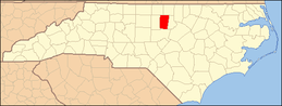 | |
| Towns | ||
| CDPs | ||
| Unincorporated communities | ||
| Footnotes | ‡This populated place also has portions in an adjacent county or counties | |
This article is issued from
Wikipedia.
The text is licensed under Creative Commons - Attribution - Sharealike.
Additional terms may apply for the media files.