Tarheel, North Carolina
| Tarheel, North Carolina | |
|---|---|
| Unincorporated community | |
 Tarheel  Tarheel | |
| Coordinates: 36°27′24″N 76°51′23″W / 36.45667°N 76.85639°WCoordinates: 36°27′24″N 76°51′23″W / 36.45667°N 76.85639°W | |
| Country | United States |
| State | North Carolina |
| County | Gates |
| Elevation | 39 ft (12 m) |
| Time zone | UTC-5 (Eastern (EST)) |
| • Summer (DST) | UTC-4 (EDT) |
| GNIS feature ID | 1025739 |
Tarheel is an unincorporated community in western Gates County, North Carolina. It is on the junction of U.S. Route 13, and U.S. Route 158, at an elevation of 39 feet (12 m).[1]
References
See also
Municipalities and communities of Gates County, North Carolina, United States | ||
|---|---|---|
| Town | 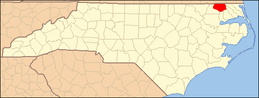 | |
| CDP | ||
| Unincorporated communities | ||
This article is issued from
Wikipedia.
The text is licensed under Creative Commons - Attribution - Sharealike.
Additional terms may apply for the media files.