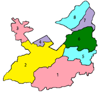
Tarati
| Tarati | |
|---|---|
| Village | |
| Coordinates: 33°07′00″N 73°10′48.60″E / 33.11667°N 73.1801667°E | |
| Country | Pakistan |
| Tehsil | Gujar Khan |
| District | Rawalpindi |
| Union council | Adhi |
| Government | |
| • Number Dar | Muhammed Banars |
| Population | |
| • Total | 1,560 |
| Ethnicity | |
| • Ethnic groups | Bhati Rajput, Gujjar, Awan |
| Faith | |
| • Religion | Islam |
| Time zone | PST +05:00 ahead of GMT |
| Area code(s) | 0513 |
| Post office | Dhoong |
Tarati (Urdu: تراٹی), is a village in Adhi Union Council, Gujar Khan Tehsil, Rawalpindi District, Punjab, Pakistan. Tarati lies at the heart of the Pothohar cultural region. The area has considerable natural resources in the form of petroleum and natural gas.It is approximately 45 kilometres southeast of Islamabad, the capital of Pakistan
Educational institutions
- Govt. Priamary School Tarati
Telecommunication
The PTCL provides the main network of landline telephone. Many ISPs and all major mobile phone, Wireless companies operating in Pakistan provide service in Tarati.
Economics
Tarati is mainly an agriculture village with wheat and groundnuts as major crops. Many of the people of Tarati are living abroad in UAE, UK, USA.
Languages
Other villages near Tarati
Dhoong, Kot Suleman, Ahdi (Union council, Narali , Daultala, Jatli (Police Station), Dhoke Adra, Dhoke Budhal, Dhoke Cheemian, Dhoke Kanyal, Dhoke Landian, Faryal, Fazolian, Kayal, Thakra Mohra, Mastala, (Dohda, Langah, Domali, Jand- Distt Chakwal).
Transport
Tarati is situated off the Daultala – Mulhal Mughlan Road. Gujar Khan is about 18 kilometers, Rawalpindi - Islamabad is about 45 kilometers and Chakwal is about 26 kilometers from Tarati. There are many ways to get around Trati which Includes public transport, Buses, Suzukis, Van, Cars, Taxis, Auto-rickshaws, Motor Cycles and Tractors.
Coordinates: 33°07′N 73°10′E / 33.117°N 73.167°E
