Tanna, Germany
| Tanna | ||
|---|---|---|
| ||
 Tanna Location of Tanna within Saale-Orla-Kreis district 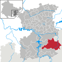 | ||
| Coordinates: 50°29′40″N 11°51′40″E / 50.49444°N 11.86111°ECoordinates: 50°29′40″N 11°51′40″E / 50.49444°N 11.86111°E | ||
| Country | Germany | |
| State | Thuringia | |
| District | Saale-Orla-Kreis | |
| Government | ||
| • Mayor | Marco Seidel | |
| Area | ||
| • Total | 87.18 km2 (33.66 sq mi) | |
| Elevation | 542 m (1,778 ft) | |
| Population (2017-12-31)[1] | ||
| • Total | 3,612 | |
| • Density | 41/km2 (110/sq mi) | |
| Time zone | CET/CEST (UTC+1/+2) | |
| Postal codes | 07922 | |
| Dialling codes | 036646 | |
| Vehicle registration | SOK | |
| Website | www.stadt-tanna.de | |

Tanna is a city in Thuringia, in the district of Saale-Orla-Kreis. It is located about 10 km south of Schleiz. Tanna was founded in 1495.
History
Within the German Empire (1871-1918), Tanna was part of the Principality of Reuss-Gera.
Population growth
Historical population (from 1994 December 31):
|
|
|
|
- Statistics since 1994: Thüringer Landesamt für Statistik
References
This article is issued from
Wikipedia.
The text is licensed under Creative Commons - Attribution - Sharealike.
Additional terms may apply for the media files.