Schleiz
| Schleiz | ||
|---|---|---|
 Church in Schleiz | ||
| ||
 Schleiz Location of Schleiz within Saale-Orla-Kreis district 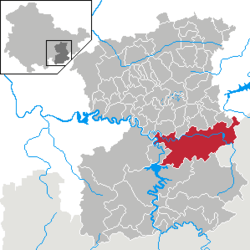 | ||
| Coordinates: 50°35′0″N 11°49′0″E / 50.58333°N 11.81667°ECoordinates: 50°35′0″N 11°49′0″E / 50.58333°N 11.81667°E | ||
| Country | Germany | |
| State | Thuringia | |
| District | Saale-Orla-Kreis | |
| Government | ||
| • Mayor | Juergen K. Klimpke (SPD) | |
| Area | ||
| • Total | 83.03 km2 (32.06 sq mi) | |
| Elevation | 432 m (1,417 ft) | |
| Population (2017-12-31)[1] | ||
| • Total | 8,464 | |
| • Density | 100/km2 (260/sq mi) | |
| Time zone | CET/CEST (UTC+1/+2) | |
| Postal codes | 07901–07907 | |
| Dialling codes | 03663 | |
| Vehicle registration | SOK | |
| Website | www.schleiz.de | |


Schleiz is a town in the district of Saale-Orla-Kreis in Thuringia, Germany.
Location
Schleiz is in the Thuringian Vogtland area, an area of wooded hills on the borders of Thuringia, Saxony, Bavaria and the Czech Republic. The city is located in a valley with the river Wisenta near the motorway A 9 (Berlin – München).
Neighboring parishes
| Crispendorf (6 km) | Görkwitz (2 km) | Oettersdorf (3 km) | Löhma (5 km) | Kirschkau (6 km) | Zeulenroda-Triebes (14 km) |
| Burgk (7 km) |  |
Pausa (13 km) | |||
| Remptendorf (12 km) | Saalburg-Ebersdorf (12 km) | Tanna (10 km) | Mühltroff (9 km) |
Distances calculated as between town centers.
Subdivisions
Schleiz includes the following subdivisions:
- Möschlitz
- Grochwitz
- Oberböhmsdorf
- Lössau
- Langenbuch
- Wüstendittersdorf
- Dröswein
- Gräfenwarth
- Oschitz
- Heinrichsruh
History
Schleiz can be traced back to a settlement established about 1200 ("Altstadt") and a separate "Neustadt" that was established next to it. The "Neustadt" had a castle and a city wall. Until 2 December 1482 they were totally separate communities after which they combined to one city. There was a settlement of the Teutonic Order here, and for some years previous to 1848 the town was the capital of the small principality of Reuss-Schleiz. In the vicinity a battle was fought, between the French and the Prussians on 9 October 1806.[2]
Within the German Empire (1871-1918), Schleiz was part of the Principality of Reuss-Gera.
20th Century
During World War 2 hundreds of women and men from several nations, including the Soviet Union were transported to Schleiz as forced laborers. At least 60 of them died there.
The palace was destroyed April 1945.
Population
Trend of population figures:
|
1834 — 1995 |
1996 — 2002
|
2003 — 2009
|
Recreation
Schleiz is also the site of the Schleizer Triangle motor racing track.

Notable people
- Bernhard Klee (born 1936), conductor
References
- ↑ "Bevölkerung der Gemeinden, Gemeinschaftsfreie Gemeinde, erfüllende/beauftragende Gemeinden, Verwaltungsgemeinschaft/Mitgliedsgemeinden in Thüringen". Thüringer Landesamt für Statistik (in German). September 2018.
- ↑ Chisholm 1911, p. 334.
- ↑ from 1960 on always as of 31st December
- ↑ Source from 1994 onwards: Thüringer Landesamt für Statistik
- Attribution

External links
- http://www.schleiz.de Official web site for Stadt Schleiz. (in German)