Taniwel
| Taniwel | |
|---|---|
| Kecamatan and village | |
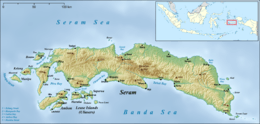 Taniwel Location in Seram Island | |
| Coordinates: 2°50′54″S 128°26′24″E / 2.84833°S 128.44000°ECoordinates: 2°50′54″S 128°26′24″E / 2.84833°S 128.44000°E | |
| Country | Indonesia |
| Province | Maluku |
| Regency | West Seram |
| Time zone | UTC+8 (WITA) |
Taniwel is a village and kecamatan on the northwestern coast of the Indonesian island of Seram.[1]
References
- ↑ "Seram Island (map)". Indonesiatravelingguide.com. Retrieved 8 June 2015.
This article is issued from
Wikipedia.
The text is licensed under Creative Commons - Attribution - Sharealike.
Additional terms may apply for the media files.