Amahai
| Amahai | |
|---|---|
| Village | |
 Amahai Location in Seram Island | |
| Coordinates: 3°20′38″S 128°55′56″E / 3.34389°S 128.93222°ECoordinates: 3°20′38″S 128°55′56″E / 3.34389°S 128.93222°E | |
| Country | Indonesia |
| Province | Maluku |
| Time zone | UTC+8 (WITA) |
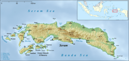
Amahai is a village on the south coast of the Indonesian island of Seram, to the south of Masohi.[1]
| Climate data for Amahai, Seram Maluku Indonesia | |||||||||||||
|---|---|---|---|---|---|---|---|---|---|---|---|---|---|
| Month | Jan | Feb | Mar | Apr | May | Jun | Jul | Aug | Sep | Oct | Nov | Dec | Year |
| Record high °C | 35 | 35 | 35 | 33 | 32 | 30 | 30 | 30 | 31 | 32 | 34 | 35 | 35 |
| Average high °C | 31 | 31 | 31 | 30 | 28 | 27 | 27 | 27 | 28 | 29 | 31 | 31 | 29 |
| Daily mean °C | 27 | 27 | 27 | 27 | 25 | 25 | 25 | 25 | 25 | 26 | 27 | 27 | 26 |
| Average low °C | 24 | 24 | 24 | 24 | 23 | 23 | 23 | 23 | 23 | 23 | 23 | 24 | 23 |
| Record low °C | 22 | 22 | 22 | 21 | 21 | 20 | 20 | 19 | 18 | 18 | 21 | 20 | 18 |
| Average precipitation mm | 120 | 110 | 130 | 270 | 510 | 630 | 600 | 400 | 240 | 150 | 110 | 130 | 3,450 |
| Record high °F | 95 | 95 | 95 | 91 | 90 | 86 | 86 | 86 | 88 | 90 | 93 | 95 | 95 |
| Average high °F | 88 | 88 | 88 | 86 | 82 | 81 | 81 | 81 | 82 | 84 | 88 | 88 | 84 |
| Daily mean °F | 81 | 81 | 81 | 81 | 77 | 77 | 77 | 77 | 77 | 79 | 81 | 81 | 79 |
| Average low °F | 75 | 75 | 75 | 75 | 73 | 73 | 73 | 73 | 73 | 73 | 73 | 75 | 73 |
| Record low °F | 72 | 72 | 72 | 70 | 70 | 68 | 68 | 66 | 64 | 64 | 70 | 68 | 64 |
| Average precipitation inches | 4.72 | 4.33 | 5.12 | 10.63 | 20.08 | 24.8 | 23.62 | 15.75 | 9.45 | 5.91 | 4.33 | 5.12 | 135.83 |
| Average rainy days | 6 | 6 | 5 | 6 | - | 23 | 22 | 18 | 12 | 9 | 7 | 7 | 121 |
| Average relative humidity (%) (daily average) | 78 | 77 | 79 | 82 | 83 | 84 | 83 | 82 | 81 | 80 | 79 | 78 | 81 |
| Mean daily sunshine hours | 12.7 | 12.6 | 12.5 | 12.4 | 12.3 | 12.3 | 12.3 | 12.4 | 12.4 | 12.5 | 12.6 | 12.7 | 12.5 |
| Source: [2] | |||||||||||||
References
- ↑ "Seram Island (map)". Indonesiatravelingguide.com. Retrieved 8 June 2015.
- ↑ "weatherbase - AMAHAI, INDONESIA". weatherbase.
This article is issued from
Wikipedia.
The text is licensed under Creative Commons - Attribution - Sharealike.
Additional terms may apply for the media files.