Tak Bai District
| Tak Bai ตากใบ | |
|---|---|
| Amphoe | |
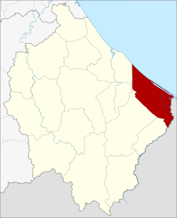 Amphoe location in Narathiwat Province | |
| Coordinates: 6°15′32″N 102°3′18″E / 6.25889°N 102.05500°ECoordinates: 6°15′32″N 102°3′18″E / 6.25889°N 102.05500°E | |
| Country | Thailand |
| Province | Narathiwat |
| Seat | Chehe |
| Amphoe established | 1909 |
| Area | |
| • Total | 253.45 km2 (97.86 sq mi) |
| Population (2009) | |
| • Total | 66,579 |
| • Density | 257.5/km2 (667/sq mi) |
| Time zone | UTC+7 (ICT) |
| Postal code | 96110 |
| Geocode | 9602 |
Tak Bai (Thai: ตากใบ, pronounced [tàːk bāj]) is a district (amphoe) in the southeastern part of Narathiwat Province, southern Thailand.
History
When the United Kingdom and Siam (Thailand) signed the Anglo-Siamese Treaty of 1909, they agreed to use the Kolok River (Sungai Golok) near Wat Chonthara Singhe (วัดชลธาราสิงเห) as the boundary between British Malaya and Siam due to the culture and arts inside the temple. Before, the area was part of the Mueang Kelantan.
The district was officially created on 12 August 1909.[1]
On 25 October 2004 at least 85 demonstrators died after a brutal police action in the so-called Tak Bai Incident.
Geography
Neighboring districts are (from the southwest clockwise) Su-ngai Kolok, Su-ngai Padi, Cho-airong, Mueang Narathiwat of Narathiwat Province, the Gulf of Thailand. To the southeast is the state Kelantan of Malaysia.
The boundary crossing is at Pengkalan Kubur (Malaysia) and Taba (Thailand).
Administration
The district is divided into eight sub-districts (tambon), which are further subdivided into 56 villages (muban). Tak Bai itself has town (thesaban mueang) status and covers parts of tambon Che He. There are a further eight tambon administrative organizations (TAO).
| No. | Name | Thai | Villages | Pop.[2] |
|---|---|---|---|---|
| 1. | Chehe | เจ๊ะเห | 8 | 19,205 |
| 2. | Phrai Wan | ไพรวัน | 10 | 8,712 |
| 3. | Phron | พร่อน | 6 | 4,418 |
| 4. | Sala Mai | ศาลาใหม่ | 8 | 8,847 |
| 5. | Bang Khun Thong | บางขุนทอง | 6 | 5,064 |
| 6. | Ko Sathon | เกาะสะท้อน | 9 | 9,219 |
| 7. | Na Nak | นานาค | 4 | 4,497 |
| 8. | Khosit | โฆษิต | 5 | 6,617 |
Attractions
Tak Bai is known as the location of Wat Chon Thara Singhe, one of the most important Buddhist temples in southern Thailand. Founded in 1873, it is notable for its wooden vihara in Sumatran style.
References
- ↑ ประกาศกระทรวงมหาดไทย ประกาศตั้งอำเภอสะเดาและอำเภอตากใบ (PDF). Royal Gazette (in Thai). 26 (0 ง): 1107. August 22, 1909.
- ↑ "Population statistics 2009". Department of Provincial Administration. Archived from the original on 3 March 2016.
External links
- amphoe.com (Thai)