Taipana
| Taipana | |
|---|---|
| Comune | |
| Comune di Taipana | |
 Taipana Location of Taipana in Italy | |
| Coordinates: 46°15′N 13°20′E / 46.250°N 13.333°ECoordinates: 46°15′N 13°20′E / 46.250°N 13.333°E | |
| Country | Italy |
| Region | Friuli-Venezia Giulia |
| Province | Province of Udine (UD) |
| Area | |
| • Total | 65.6 km2 (25.3 sq mi) |
| Elevation | 478 m (1,568 ft) |
| Population (Dec. 2004) | |
| • Total | 737 |
| • Density | 11/km2 (29/sq mi) |
| Time zone | UTC+1 (CET) |
| • Summer (DST) | UTC+2 (CEST) |
| Postal code | 33040 |
| Dialing code | 0432 |
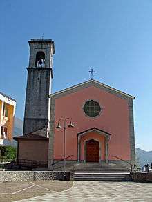
Parish Church
Taipana (Slovene: Tipana; Friulian: Taipane) is a comune (municipality) in the Province of Udine in the Italian region Friuli-Venezia Giulia, located about 80 kilometres (50 mi) northwest of Trieste and about 20 kilometres (12 mi) northeast of Udine, on the border with Slovenia. As of 31 December 2004, it had a population of 737 and an area of 65.6 square kilometres (25.3 sq mi).[1] According to the census 1971 74,4% of the population are Slovenes.
Taipana borders the following municipalities: Attimis, Kobarid (Slovenia), Faedis, Lusevera, Nimis.
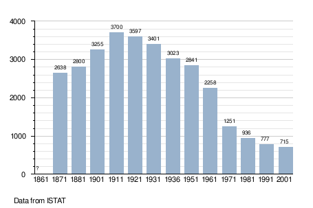
Demographic evolution
References
See also

This article is issued from
Wikipedia.
The text is licensed under Creative Commons - Attribution - Sharealike.
Additional terms may apply for the media files.