Arta Terme
| Arta Terme | ||
|---|---|---|
| Comune | ||
| Comune di Arta Terme | ||
 | ||
| ||
 Arta Terme Location of Arta Terme in Italy | ||
| Coordinates: 46°29′N 13°1′E / 46.483°N 13.017°ECoordinates: 46°29′N 13°1′E / 46.483°N 13.017°E | ||
| Country | Italy | |
| Region | Friuli-Venezia Giulia | |
| Province | Udine (UD) | |
| Frazioni | Avosacco, Cabia, Cedarchis, Lovea, Piano d'Arta, Piedim, Rivalpo, Valle | |
| Government | ||
| • Mayor | Luigi Gonano | |
| Area | ||
| • Total | 52.7 km2 (20.3 sq mi) | |
| Elevation | 422 m (1,385 ft) | |
| Population (28 February 2017)[1] | ||
| • Total | 2,102 | |
| • Density | 40/km2 (100/sq mi) | |
| Demonym(s) | Artesi | |
| Time zone | UTC+1 (CET) | |
| • Summer (DST) | UTC+2 (CEST) | |
| Postal code | 33022 | |
| Dialing code | 0433 | |
| Patron saint | Sts. Hermacoras and Fortunatus | |
| Saint day | July 12 | |
| Website | Official website | |

Arta Terme (Friulian: Darte) is a comune (municipality) in the Province of Udine in the Italian region Friuli-Venezia Giulia, located about 110 kilometres (68 mi) northwest of Trieste and about 50 kilometres (31 mi) northwest of Udine in the Val Bût, part of the Alpine traditional region of Carnia.
Main sights
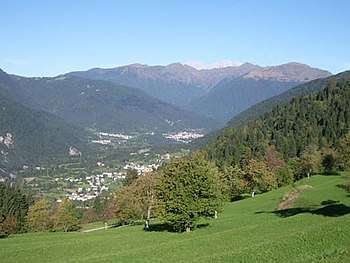
view of the town
- Church of Santo Spirito (15th century)
- Church of San Nicolò (15th century)
Twin towns
Arta Terme is twinned with:

References
External links

This article is issued from
Wikipedia.
The text is licensed under Creative Commons - Attribution - Sharealike.
Additional terms may apply for the media files.