Maigo, Lanao del Norte
| Maigo | ||
|---|---|---|
| Municipality | ||
| Municipality of Maigo | ||
| ||
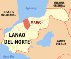 Map of Lanao del Norte with Maigo highlighted | ||
.svg.png) Maigo Location within the Philippines | ||
| Coordinates: 8°09′N 123°58′E / 8.15°N 123.97°ECoordinates: 8°09′N 123°58′E / 8.15°N 123.97°E | ||
| Country |
| |
| Region | Northern Mindanao (Region X) | |
| Province | Lanao del Norte | |
| District | 1st District | |
| Founded | February 27, 1959 | |
| Barangays | 13 (see Barangays) | |
| Government [1] | ||
| • Type | Sangguniang Bayan | |
| • Mayor | Rafael C. Rizalda | |
| • Vice Mayor | Elmer R. Ramos | |
| • Electorate | 13,199 voters (2016) | |
| Area [2] | ||
| • Total | 121.45 km2 (46.89 sq mi) | |
| Population (2015 census)[3] | ||
| • Total | 21,666 | |
| • Density | 180/km2 (460/sq mi) | |
| Time zone | UTC+8 (PST) | |
| ZIP code | 9206 | |
| PSGC | 103512000 | |
| IDD : area code | +63 (0)63 | |
| Climate type | Tropical climate | |
| Income class | 4th municipal income class | |
| Revenue (₱) | 74,283,482.29 (2016) | |
| Native languages |
Maranao Cebuano Binukid Tagalog | |
| Website |
www | |

Maigo, officially the Municipality of Maigo, is a 4th class municipality in the province of Lanao del Norte, Philippines. According to the 2015 census, it has a population of 21,666 people.[3]
Barangays
Maigo is politically subdivided into 13 barangays.
- Balagatasa
- Camp
- Claro M. Recto
- Inoma
- Labuay
- Liangan West
- Mahayahay
- Maliwanag
- Mentring
- Poblacion
- Santa Cruz
- Sigapod
- Kulasihan (Villanueva)
History
The town was originally part of Kolambugan before it was declared a municipality of its own. It was created a few years after the neighboring town of Bacolod was separated from Kolambugan. Executive Order No. 331 created Maigo from the following:
- From Kolambugan: Maigo, Balagatasa, Sigapud, and Mentring and their respective sitios.
- From Bacolod: Liagan Proper, Barogohan, Camps I, II, and III and their respective sitios.
A simple town where Muslims and Christians are living in harmony. But in recent years it had been the target of Moro Islamic Liberation Front which would later result to the fear of the people. Many locals have migrated to other places in Lanao del Norte[4] and to Manila to avoid the fighting.
Settlement
Originally and before Spain Invasion and later American Invasion, majority people living in Miago are Maranao Tribe. In folk story from the old leaders said, during Spain occupation, some of the leaders from the interior areas of lanao del norte they usually cross the beach of municipality of kolambogan to beach of Ozamis City by boat to catch people living in other side and make them as worker (personal helper) or other said BISAYA in maranaw term. There was also a story that Mutia Family in Zamboanga del Norte and Misamis Occidental is originally came from Interior area in Lanao del Norte and even now still existing the story because of the great-great-great grandfather of their great-great grandfather of Mutia Families in Zamboanga del Norte and Misamis Occidental lifted a small one piece of book hanging in the center of the house and said to the children the forbidden and do not even touch of even open the book, and according to the claimed soon for many years when somebody open they saw writing but not familiar (Spanish language, English language), and some say that near to Arabic letters.
In long living and social process and sometimes in 1935 – 1944, under the National Land Settlement Administration (NLSA) of the Commonwealth Government, there was a Philippine House of Representative proposal to invade the Island of Mindanao to use the some land to help the Philippine Government, and one of the opposition that time is Congressman Datu Salipada Khalid Pendatun. The proposal was approved and signed by President Manuel L. Quezon, he is the president that time. The settlers are compose of people have knowledge about skill job, Agri Technician, Engineers, Farming.
The settlers are compose of different people from the Islands of Visayas and Island Luzon that has knowledge and experience of Agriculture, Technical, Farming, Lumber, Carpenter etc. The first batch transport were landed to the following Areas:
- Some parts of Zamboanga
- Misamis Occidental
- Lanao Del Norte
- Misamis Oriental
- Some part of Surigao
- Some part of Davao
- Some Part of Cotabato
In Lanao del Norte, the transport of settlers was peacefully successful due to the smooth negotiations with the Maranao Tribal Leaders and Land Lords. As Welcome sign, the Land lords has donate piece of land (piece of land before are more than 5 hectares) to start the settlers life as beginning of life. In long run and process, the family of settler works to the land owners and as a gift since they are very good workers, the land lord gave the small piece of land as a gift. Some say that, settlers trade they made the business to the land lord just few item exchange of lands. Some family of land lords marry the daughter of their workers which result and until the majority living in Lanao del Norte and Misamis Occidental has blood in Maranao Tribe (Muslim Blood).
On the hand, the settlement has going problem and conflict between Non-Muslim and Muslim when Martial Law is implemented.
Demographics
| Population census of Maigo | ||
|---|---|---|
| Year | Pop. | ±% p.a. |
| 1960 | 8,662 | — |
| 1970 | 10,578 | +2.02% |
| 1975 | 10,945 | +0.69% |
| 1980 | 12,556 | +2.78% |
| 1990 | 14,613 | +1.53% |
| 1995 | 16,822 | +2.67% |
| 2000 | 17,826 | +1.25% |
| 2007 | 18,706 | +0.67% |
| 2010 | 20,131 | +2.71% |
| 2015 | 21,666 | +1.41% |
| Source: Philippine Statistics Authority[3][5][6][7] | ||
Mayors after People Power Revolution 1986
- 1986 - 1989,
- 1989 - 1992,
- 1992 - 1995,
- 1995 - 1998,
- 1998 - 2001,
- 2001 - 2004, Rafael C. Rizalda
- 2004 - 2007, Rafael C. Rizalda
- 2007 - 2010, Rizalda
- 2010 - 2013, Rafael C. Rizalda
- 2013 - 2016, Rafael C. Rizalda
- 2016 present, Rafael C. Rizalda
References
- ↑ "Municipality". Quezon City, Philippines: Department of the Interior and Local Government. Retrieved 31 May 2013.
- ↑ "Province: Lanao del Norte". PSGC Interactive. Quezon City, Philippines: Philippine Statistics Authority. Retrieved 12 November 2016.
- 1 2 3 Census of Population (2015). "Region X (Northern Mindanao)". Total Population by Province, City, Municipality and Barangay. PSA. Retrieved 20 June 2016.
- ↑ League of Provinces by: Roberto C. Arellano
- ↑ Census of Population and Housing (2010). "Region X (Northern Mindanao)". Total Population by Province, City, Municipality and Barangay. NSO. Retrieved 29 June 2016.
- ↑ Censuses of Population (1903–2007). "Region X (Northern Mindanao)". Table 1. Population Enumerated in Various Censuses by Province/Highly Urbanized City: 1903 to 2007. NSO.
- ↑ "Province of Lanao del Norte". Municipality Population Data. Local Water Utilities Administration Research Division. Retrieved 17 December 2016.
External links
- Philippine Standard Geographic Code
- Philippine Census Information
- Local Governance Performance Management System
Places adjacent to Maigo, Lanao del Norte | |
|---|---|
Tubod (capital) | |
| Municipalities | |
| Highly urbanized city |
|