TIROS-2
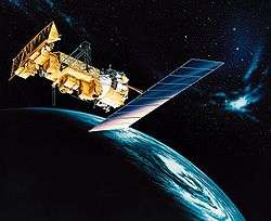
 TIROS-2 before launch | |
| Mission type | Weather satellite |
|---|---|
| Operator | NASA[1] |
| COSPAR ID | 1960-016A |
| SATCAT no. | 63 |
| Mission duration | 376 days |
| Spacecraft properties | |
| Spacecraft type | TIROS |
| Manufacturer |
RCA Astro GSFC |
| Launch mass | 127 kilograms (280 lb)[2] |
| Start of mission | |
| Launch date | November 23, 1960, 11:13:03 UTC[3] |
| Rocket | Thor DM-19 Delta |
| Launch site | Cape Canaveral LC-17A |
| End of mission | |
| Last contact | December 4, 1961 |
| Decay date | May 2014 |
| Orbital parameters | |
| Reference system | Geocentric |
| Regime | Low Earth |
| Semi-major axis | 6,755.43 kilometers (4,197.63 mi) |
| Eccentricity | 0.0014596 |
| Perigee | 374 kilometers (232 mi) |
| Apogee | 394 kilometers (245 mi) |
| Inclination | 48.51 degrees |
| Period | 92.09 minutes |
| Epoch | December 8, 2013, 11:58:18 UTC[4] |
| Instruments | |
|
Widefield Radiometer Scanning Radiometer Television Camera System | |
TIROS 2 (or TIROS-B) was a spin-stabilized meteorological satellite. It was the second in a series of Television Infrared Observation Satellites. It re-entered in May 2014.[5]
Launch

TIROS 2 was launched on November 23, 1960 at 11:13:03 UTC, by a Thor-Delta rocket from Cape Canaveral, Florida. The spacecraft functioned nominally until January 22, 1961. The satellite orbited the Earth once every 98 minutes, at an inclination of 48.5°. Its perigee was 609 kilometers (329 nmi) and apogee was 742 kilometers (401 nmi).
The satellite maintained a spin rate of 8–12 rpm by the use of five diametrically opposed pairs of small, solid-fuel thrusters. The spin axis could be oriented to within 1–2° accuracy by the use of a magnetic attitude control device, consisting of 250 cores of wire wound around the outer surface of the spacecraft. The interaction between the induced magnetic field in the spacecraft and the earth's magnetic field provided the necessary torque for attitude control. The spacecraft functioned nominally until January 22, 1961.
TIROS 2 was powered by 9,260 1-by-2-cm silicon solar cells. It had two independent television camera subsystems for taking pictures of cloud cover, plus a five-channel medium-resolution scanning radiometer and a two channel non-scanning low resolution radiometer for measuring radiation from the earth and its atmosphere.
Instruments
TIROS 2 added two infrared radiometers to TIROS 1 instruments, which allowed more analysis of frontal zones.[6]
References
- ↑ "TIROS". NASA Science. Archived from the original on December 9, 2014. Retrieved December 8, 2013.
- ↑ "TIROS 2". National Space Science Data Center. Retrieved December 8, 2013.
- ↑ McDowell, Jonathan. "Launch Log". Jonathan's Space Page. Retrieved December 8, 2013.
- ↑ "TIROS 2 Satellite details 1960-016A NORAD 63". N2YO. December 8, 2013. Retrieved December 8, 2013.
- ↑ TIROS 2
- ↑ Hawkins, R. S. (October 1, 1964). "Analysis and Interpretation of TIROS II Infrared Radiation Measurements". Journal of Applied Meteorology. 3 (5): 564–572. doi:10.1175/1520-0450(1964)0032.0.CO;2. ISSN 0021-8952.