Swansea Village Historic District
|
Swansea Village Historic District | |
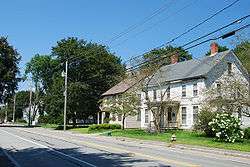 Main Street | |
  | |
| Location | Swansea, Massachusetts |
|---|---|
| Coordinates | 41°44′47″N 71°11′26″W / 41.74639°N 71.19056°WCoordinates: 41°44′47″N 71°11′26″W / 41.74639°N 71.19056°W |
| Area | 29 acres (12 ha) |
| Architect | Unknown |
| Architectural style | Italianate, Georgian, Federal |
| MPS | Swansea MRA |
| NRHP reference # | [1] |
| Added to NRHP | February 16, 1990 |
Swansea Village Historic District is a historic district roughly along Main Street from Gardners Neck Road to Stephens Road, and Ledge Road in Swansea, Massachusetts. The district encompasses what emerged in the late 18th century as the principal municipal center of the town. The area that became Swansea Village was owned until about 1720 by members of the Eddy family, whose family graveyard lies in the district. By the early 19th century the junction of Main, Elm, and Stephens began to take shape as the nucleus of the village, and a meeting house, library, and eventually town hall followed.[2]
The district was added to the National Register of Historic Places in 1990.[1]
See also
References
- 1 2 National Park Service (2008-04-15). "National Register Information System". National Register of Historic Places. National Park Service.
- ↑ "NRHP nomination for Swansea Village Historic District". Commonwealth of Massachusetts. Retrieved 2014-06-27.
| Topics |  | ||||||||||||||||
|---|---|---|---|---|---|---|---|---|---|---|---|---|---|---|---|---|---|
| Lists by county | |||||||||||||||||
| Lists by city |
| ||||||||||||||||
| Other lists | |||||||||||||||||
| |||||||||||||||||
This article is issued from
Wikipedia.
The text is licensed under Creative Commons - Attribution - Sharealike.
Additional terms may apply for the media files.