Suttons Bay, Michigan
| Suttons Bay, Michigan | |
|---|---|
| Village | |
| Village of Suttons Bay | |
  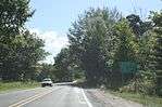 From top to bottom, counterclockwise: Post office, looking south at downtown on M-22, sign on M-22. | |
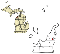 Location in the State of Michigan | |
| Coordinates: 44°58′30″N 85°39′4″W / 44.97500°N 85.65111°W | |
| Country |
|
| State |
|
| County |
|
| Area[1] | |
| • Total | 1.25 sq mi (3.24 km2) |
| • Land | 1.25 sq mi (3.24 km2) |
| • Water | 0 sq mi (0 km2) |
| Elevation | 597 ft (182 m) |
| Population (2010)[2] | |
| • Total | 618 |
| • Estimate (2016)[3] | 620 |
| • Density | 490/sq mi (190/km2) |
| Time zone | UTC-5 (EST) |
| • Summer (DST) | UTC-4 (EDT) |
| ZIP code | 49682 |
| Area code(s) | 231 |
| FIPS code | 26-77600[4] |
| GNIS feature ID | 0639135[5] |
Suttons Bay is a village in Leelanau County in the U.S. state of Michigan. The population was 618 at the 2010 census. The village was incorporated in 1898 and is located within Suttons Bay Township.
History
The community is named for one of the first settlers of European descent, Harry C. Sutton, who arrived in 1854. He arrived with a crew of woodsmen to supply fuel for passing wood steamboats.
In 1903 the Traverse City, Leelanau, and Manistique Railroad began a route between Traverse City to the South and Northport to the North, stopping at Suttons Bay, as well as Hatch's Crossing, Fountain Point, Bingham, Keswick, and Omena.[6]
Before the turn of the 20th century, four churches had been established—two Lutheran, one Roman Catholic, and one Congregational.
In 1920, Leelanau County voters approved moving the county seat to Suttons Bay, but the move never took place.
Suttons Bay has a school; the sports mascot is a Viking, hence the nickname "Suttons Bay Norsemen."
The town is home to the county's only movie theater, opened in 1946. It is now owned by Bob Bahle, and was renovated in 1977. Its fare consists of unique art house films, and occasionally the theater hosts plays and concerts.
The town has a clothing store that has been owned by one family over four generations called "Bahles." The original store started as a "dry-goods" business in 1876 by Lars Bahle, an immigrant from Norway.
A unique shopping experience can be had in Suttons Bay. From fudge shops, to an upscale kitchen store, to a spice shop and fun science store. It also is home to the largest greenhouse and garden center north of Grand Rapids. (Plant Masters of Suttons Bay)
Suttons Bay is also home to one of the oldest continuously operated food establishments in the entire region. Since 1871, the restaurant has gone through several owners and is currently known as The V I Grill.
Culture
Like many other communities in northern Michigan, Suttons Bay relies heavily on tourism to generate revenues for its economy.
Activities include the Suttons Bay Jazzfest and the Suttons Bay Art Festival.
Suttons Bay also is highly embedded in the cherry industry, producing sweet and tart cherries of many varieties. Harvest operations usually take place in mid-July and run into August.
In August 2013, the community held an event to attempt to break the Guinness Book of World Records for most kayaks and canoes rafted together. The effort followed an attempt a year earlier, which missed the record of 1902 boats set by a group near Inlet, New York in 2011.[7][8]
Geography
According to the United States Census Bureau, the village has a total area of 1.25 square miles (3.24 km2), all land.[1] The town is located on the shore of Suttons Bay, an inlet of Lake Michigan, one of five lakes that comprise the Great Lakes. The town is fifteen miles north of Traverse City, along M-22.
Nearby is a sign marking the 45th parallel north, halfway between the North Pole and the Equator. This is one of six Michigan sites, and 29 in the U.S., where such signs are known to exist.[9][10]
Demographics
| Historical population | |||
|---|---|---|---|
| Census | Pop. | %± | |
| 1900 | 398 | — | |
| 1910 | 402 | 1.0% | |
| 1920 | 392 | −2.5% | |
| 1930 | 439 | 12.0% | |
| 1940 | 470 | 7.1% | |
| 1950 | 485 | 3.2% | |
| 1960 | 421 | −13.2% | |
| 1970 | 522 | 24.0% | |
| 1980 | 504 | −3.4% | |
| 1990 | 561 | 11.3% | |
| 2000 | 589 | 5.0% | |
| 2010 | 618 | 4.9% | |
| Est. 2016 | 620 | [3] | 0.3% |
| U.S. Decennial Census[11] | |||
2010 census
As of the census[2] of 2010, there were 618 people, 273 households, and 175 families residing in the village. The population density was 494.4 inhabitants per square mile (190.9/km2). There were 453 housing units at an average density of 362.4 per square mile (139.9/km2). The racial makeup of the village was 93.7% White, 0.2% African American, 2.8% Native American, 1.1% Asian, and 2.3% from two or more races. Hispanic or Latino of any race were 0.3% of the population.
There were 273 households of which 16.1% had children under the age of 18 living with them, 54.6% were married couples living together, 6.2% had a female householder with no husband present, 3.3% had a male householder with no wife present, and 35.9% were non-families. 32.2% of all households were made up of individuals and 15.1% had someone living alone who was 65 years of age or older. The average household size was 2.02 and the average family size was 2.48.
The median age in the village was 58.8 years. 12.8% of residents were under the age of 18; 3.5% were between the ages of 18 and 24; 14.5% were from 25 to 44; 29.8% were from 45 to 64; and 39.3% were 65 years of age or older. The gender makeup of the village was 44.7% male and 55.3% female.
2000 census
As of the census[4] of 2000, there were 589 people, 271 households, and 179 families residing in the village. The population density was 538.7 per square mile (208.6/km²). There were 374 housing units at an average density of 342.0 per square mile (132.5/km²). The racial makeup of the village was 96.94% White, 0.34% African American, 1.19% Native American, 0.34% Asian, 1.02% from other races, and 0.17% from two or more races. Hispanic or Latino of any race were 2.72% of the population.
There were 271 households out of which 21.8% had children under the age of 18 living with them, 56.1% were married couples living together, 7.4% had a female householder with no husband present, and 33.6% were non-families. 28.8% of all households were made up of individuals and 12.5% had someone living alone who was 65 years of age or older. The average household size was 2.17 and the average family size was 2.62.
In the village, the population was spread out with 19.5% under the age of 18, 4.6% from 18 to 24, 20.7% from 25 to 44, 32.6% from 45 to 64, and 22.6% who were 65 years of age or older. The median age was 47 years. For every 100 females, there were 92.5 males. For every 100 females age 18 and over, there were 90.4 males.
The median income for a household in the village was $44,063, and the median income for a family was $52,321. Males had a median income of $38,173 versus $22,045 for females. The per capita income for the village was $24,097. About 3.6% of families and 6.0% of the population were below the poverty line, including 8.4% of those under age 18 and 3.8% of those age 65 or over.
References
- 1 2 "US Gazetteer files 2010". United States Census Bureau. Archived from the original on 24 January 2012. Retrieved 25 November 2012.
- 1 2 "American FactFinder". United States Census Bureau. Retrieved 25 November 2012.
- 1 2 "Population and Housing Unit Estimates". Retrieved June 9, 2017.
- 1 2 "American FactFinder". United States Census Bureau. Retrieved 2008-01-31.
- ↑ "US Board on Geographic Names". United States Geological Survey. 2007-10-25. Retrieved 2008-01-31.
- ↑ Suttons Bay Chamber of Commerce Archived 14 August 2007 at the Wayback Machine.. Retrieved 2008-09-15.
- ↑ Detroit News, September 1, 2013
- ↑ MLive Media Group, September 1, 2013
- ↑ Photographs, Suttons Bay 45th Parallel signs.
- ↑ List and map of 45th Parallel markers, with links to pictures (accessed 17 December 2007).
- ↑ "Census of Population and Housing". Census.gov. Retrieved June 4, 2015.
Further reading
External links
Municipalities and communities of Leelanau County, Michigan, United States | ||
|---|---|---|
| City | 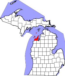 | |
| Villages | ||
| Charter township | ||
| General law townships | ||
| CDPs | ||
| Other unincorporated communities | ||
| Indian reservation | ||
| Footnotes | ‡This populated place also has portions in an adjacent county or counties | |
Coordinates: 44°58′36″N 85°39′02″W / 44.97667°N 85.65056°W