Sugar Tit, South Carolina
| Sugar Tit | |
|---|---|
| Unincorporated community | |
 Sugar Tit Location within the state of South Carolina | |
| Coordinates: 34°51′11.2″N 82°09′02.6″W / 34.853111°N 82.150722°WCoordinates: 34°51′11.2″N 82°09′02.6″W / 34.853111°N 82.150722°W | |
| Country | United States |
| State | South Carolina |
| County | Spartanburg |
| Elevation | 778 ft (237 m) |
| Time zone | UTC-5 (Eastern (EST)) |
| • Summer (DST) | UTC-4 (EDT) |
| GNIS feature ID | 1250052[1] |
Sugar Tit is an unincorporated community in Spartanburg County in the upstate of the U.S. state of South Carolina. The Sugar Tit area has about five mile radius around Joe’s Lake. It is located around the junction of State 101 and State 296 southeast of Greer, between Reidville and Five Forks.[2] It is mostly farmland and plantations. After BMW came more subdivisions and industrial parks appeared in the area.[3]
Sugar Tit received its name when the men spent so long socializing at the local general store, their wives complained they took to the store like a baby to a sugar tit.[4]
References
- ↑ U.S. Geological Survey Geographic Names Information System: Sugar Tit, South Carolina
- ↑ "What's in a name? Ask any resident of Sugar Tit, S.C." GateHouse Media, Inc. Retrieved 5 September 2017.
- ↑ "Joe's Lake". GateHouse Media, Inc. Retrieved 5 September 2017.
- ↑ Leonard, Michael (July 21, 1983). "Series on Spartanburg County Communities' Colorful Past Ends". Herald-Journal. pp. B1. Retrieved 28 April 2015.
External links
Municipalities and communities of Spartanburg County, South Carolina, United States | ||
|---|---|---|
| Cities | 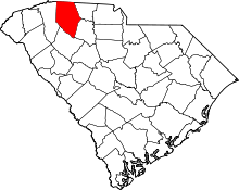 | |
| Towns | ||
| CDPs | ||
| Unincorporated communities | ||
| Ghost town | ||
| Footnotes | ‡This populated place also has portions in an adjacent county or counties | |
This article is issued from
Wikipedia.
The text is licensed under Creative Commons - Attribution - Sharealike.
Additional terms may apply for the media files.