Stringfellow Unit
 Location in Texas | |
| Location |
1200 FM 655 Rosharon, Texas 77583 |
|---|---|
| Coordinates | 29°17′56″N 95°32′21″W / 29.29889°N 95.53917°WCoordinates: 29°17′56″N 95°32′21″W / 29.29889°N 95.53917°W |
| Status | Operational |
| Security class | G1-G4, Outside Trusty |
| Capacity | Unit: 893 Trusty Camp: 319 |
| Opened | July 1908 |
| Former name | Ramsey II Unit |
| Managed by | TDCJ Correctional Institutions Division |
| Warden |
Patrick Cooper Kenneth Jolley |
| County | Brazoria County |
| Country | USA |
| Website |
www |

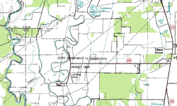
The A. M. "Mac" Stringfellow Unit (previously Ramsey II Unit) is a Texas Department of Criminal Justice prison located in unincorporated Brazoria County, Texas, with a Rosharon, Texas postal address it is not inside the Rosharon census-designated place.[1] The prison is located on Farm to Market Road 655, 4 miles (6.4 km) west of Farm to Market Road 521,[2] and about 30 miles (48 km) south of Houston.[3] The unit is co-located with the Ramsey Unit and the Terrell Unit on a 16,369-acre (6,624 ha) plot of land.[2]
History
The unit opened in July 1908.[2] The Ramsey Prison Farm consisted of five former plantations.[4] In 1963, before racial desegregation occurred, the Ramsey II Unit housed African-American prisoners over the age of 25.[5]
Operations
The Stringfellow Unit is within the attendance zone of the Alvin Community College. Stringfellow was included through H.B. No. 2744,[6] filed on March 6, 2007.[7]
References
- ↑ "2010 CENSUS - CENSUS BLOCK MAP: Rosharon CDP, TX." U.S. Census Bureau. Retrieved on January 21, 2018.
- 1 2 3 "Stringfellow Unit Archived 2008-08-21 at the Wayback Machine.." Texas Department of Criminal Justice. Retrieved on July 20, 2010.
- ↑ "Inmate recaptured after slipping from work squad." Associated Press at KTRK-TV. Wednesday September 5, 2007. Retrieved on November 19, 2010.
- ↑ "Convict Leasing and State Account Farming (1883-1909)." Texas State Library and Archives. Retrieved on April 29, 2011.
- ↑ Trulson, Chad R., James W. Marquart, and Ben M. Crouch. First Available Cell: Desegregation of the Texas Prison System. University of Texas Press, 2009. 82. Retrieved from Google Books on July 20, 2010. ISBN 0-292-71983-3, ISBN 978-0-292-71983-5.
- ↑ "H.B. No. 2744." Texas Legislature. Retrieved on March 11, 2011. "(3) the territory located in Brazoria County, situated to the west of the Alvin Community College District boundary as it existed on January 1, 2003, extending west to the eastern border of Fort Bend County, and south to County Roads 49, 34, and 255, including the City of Rosharon and the Darrington and Ramsey Units of the Texas Department of Criminal Justice."
- ↑ "Bill: HB 2744." Texas Legislature. Retrieved on March 11, 2011.
External links
| Region I | |
|---|---|
| Region II | |
| Region III | |
| Region IV | |
| Region V | |
| Region VI | |
| Private | |
| Former units | |
Above facilities are male-only unless noted by ♀(female-only) | |