Sterling Hill Historic District (Bridgeport, Connecticut)
|
Sterling Hill Historic District | |
 Pequonnock Street | |
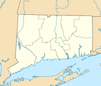  | |
| Location | Roughly bounded by Pequonnock St., Harral Ave., James St. and Washington Ave., Bridgeport, Connecticut |
|---|---|
| Coordinates | 41°10′51″N 73°10′44″W / 41.18083°N 73.17889°WCoordinates: 41°10′51″N 73°10′44″W / 41.18083°N 73.17889°W |
| Architect | Multiple |
| Architectural style | Greek Revival, Gothic, Federal |
| NRHP reference # | 92000335[1] |
| Added to NRHP | April 2, 1992 |
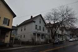
The Sterling Hill Historic District in Bridgeport, Connecticut is a historic district that was listed on the National Register of Historic Places in 1992.[1] The district is a two-block area of 43 urban residential structures dating as far back as 1821. Most of the buildings are from later in the 19th century when the neighborhood was largely occupied by Irish working-class residents. Most of the early buildings are vernacular wood-frame structures with modest Federal, Greek Revival, or Gothic Revival details, while the later additions include multiunit tenement-style buildings. The area includes the oldest urbanized part of the city.[2]
See also
References
- 1 2 National Park Service (2009-03-13). "National Register Information System". National Register of Historic Places. National Park Service.
- ↑ Charles W. Brilvitch (1991-10-24). "National Register of Historic Places Registration Form" (pdf). National Park Service. Retrieved 2010-07-28. and 12 accompanying photographs.
| Topics | |
|---|---|
| Lists by states |
|
| Lists by insular areas | |
| Lists by associated states | |
| Other areas | |
| |
This article is issued from
Wikipedia.
The text is licensed under Creative Commons - Attribution - Sharealike.
Additional terms may apply for the media files.