St Francis Island
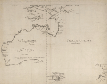
The island appears on this 1644 map as "I St. François"
St Francis Island (originally in Dutch: Eyland St. François) is an island on the south coast of South Australia near Ceduna. It is part of the Nuyts Archipelago. It was one of the first parts of South Australia to be discovered and named by Europeans, along with St Peter Island, mapped by François Thijssen in 't Gulden Zeepaert in 1627.
Protected area status
Statutory reserves
The island is part of the Nuyts Archipelago Wilderness Protection Area while the waters surrounding its shores are within the Nuyts Archipelago Marine Park.[1][2][3]
Non-statutory arrangements
Important Bird Area
The island is part of the Nuyts Archipelago Important Bird Area (IBA), so identified by BirdLife International because it supports over 1% of the world populations of short-tailed shearwaters, white-faced storm-petrels and pied oystercatchers.[4]
See also
References
- ↑ "Wilderness Advisory Committee Annual Report 2012-13" (PDF). September 2013: 18 & 23. ISSN 1832-9357. Retrieved 17 March 2014.
- ↑ Anon (2006). Island Parks of Western Eyre Peninsula Management Plan (PDF). Adelaide: Department for Environment and Heritage, South Australia. p. 2. ISBN 1-921238-18-6.
- ↑ "NUYTS ARCHIPELAGO MARINE PARK MANAGEMENT PLAN 2012" (PDF). Department of Environment, Water and Natural Resources. p. 5. Retrieved 18 October 2014.
- ↑ "IBA: Nuyts Archipelago". Birdata. Birds Australia. Retrieved 2011-09-05.
| West coast of Eyre Peninsula |
| ||||||||
|---|---|---|---|---|---|---|---|---|---|
| Spencer Gulf |
| ||||||||
| Investigator Strait | |||||||||
| Kangaroo Island |
| ||||||||
| Gulf St Vincent | |||||||||
| Backstairs Passage | |||||||||
| Encounter Bay and adjoining waters | |||||||||
| South east coast | |||||||||
| Mainland |
| ||||||||
| |||||||||
This article is issued from
Wikipedia.
The text is licensed under Creative Commons - Attribution - Sharealike.
Additional terms may apply for the media files.