St. Margaret's Bay, Nova Scotia (administrative district)
| St. Margarets Bay | |
|---|---|
| Administrative District | |
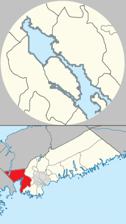 Location of St. Margarets Bay planning area of municipal Halifax. | |
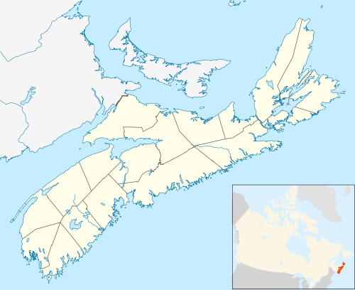 St. Margarets Bay Location within Nova Scotia | |
| Coordinates: 44°38′40″N 63°40′34″W / 44.6444°N 63.6762°WCoordinates: 44°38′40″N 63°40′34″W / 44.6444°N 63.6762°W | |
| Country |
|
| Province |
|
| Municipality | Halifax Regional Municipality |
| Founded | 1612 (Head of St. Margarets Bay) |
| Communities | Black Point, Boutiliers Point, French Village, Glen Haven, Glen Margaret, Hackett's Cove, Head of St. Margaret's Bay, Hubbards, Hubley, Indian Harbour, Ingramport, Lewis Lake, Peggys Cove, Queensland, Seabright, Simms Settlement, Tantallon, Upper Tantallon |
| Government | |
| • Council | Western Region Community Council |
| Time zone | UTC−4 (AST) |
| • Summer (DST) | UTC−3 (ADT) |
| Area code(s) | 902 |
| Part of a series about Places in Nova Scotia | |
St. Margaret's Bay is the westernmost administrative planning district of the Halifax Regional Municipality in the Canadian province of Nova Scotia.
It is a rural area located on the southwestern part of Halifax County comprising those communities in the county located on the eastern and northern shores of St. Margaret's Bay through to the county line, terminating at the community of Hubbards. It borders on Hants County to the north and on Lunenburg County to the west.[1]
References
- ↑ "Planning Districts 1 and 3 (St. Margaret's Bay) Area Plan". Halifax. Retrieved 4 July 2017.
| Government | |
|---|---|
| Services and agencies | |
| Articles of interest | |
| Education | |
| Major neighbourhoods & communities |
|
| |
This article is issued from
Wikipedia.
The text is licensed under Creative Commons - Attribution - Sharealike.
Additional terms may apply for the media files.