St. Clair Springs, Alabama
| St. Clair Springs | |
|---|---|
| Unincorporated community | |
 St. Clair Springs  St. Clair Springs | |
| Coordinates: 33°45′51″N 86°24′17″W / 33.76417°N 86.40472°WCoordinates: 33°45′51″N 86°24′17″W / 33.76417°N 86.40472°W | |
| Country | United States |
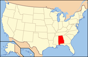
| State | Alabama |
| County | St. Clair |
| Elevation | 659 ft (201 m) |
| Time zone | UTC-6 (Central (CST)) |
| • Summer (DST) | UTC-5 (CDT) |
| GNIS feature ID | 164843[1] |
|
St. Clair Springs | |
|
| |
| Architectural style | Late Victorian, Stick/Eastlake |
| NRHP reference # | 76002140[2] |
| Added to NRHP | April 26, 1976 |
St. Clair Springs is an unincorporated community and historic district in St. Clair County, Alabama, United States.
Beginning in the 1840s, people came to the area to camp around the springs. A four-room tavern was built sometime before the Civil War. In 1875, the St. Clair Springs Hotel was built near the springs, and several private homes were built in the 1880s. The hotel closed in 1902, but was soon replaced by the St. Clair Inn. The Inn burned in 1925, which effectively ended the area's tourism popularity.[3]
The historic district was listed on the National Register of Historic Places in 1976 and includes 23 structures. The majority of houses are small Victorian cottages originally built as summer homes.[3]
References
- ↑ "Saint Clair Springs". Geographic Names Information System. United States Geological Survey.
- ↑ National Park Service (2010-07-09). "National Register Information System". National Register of Historic Places. National Park Service.
- 1 2 Floyd, W. Warner (October 7, 1974). "St. Clair Springs". National Register of Historic Places Inventory-Nomination Form. National Park Service. Retrieved December 1, 2017. See also: "Accompanying photos". Retrieved December 1, 2017.
Municipalities and communities of St. Clair County, Alabama, United States | ||
|---|---|---|
| Cities | 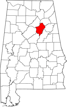 | |
| Towns | ||
| Unincorporated communities | ||
| Former towns | ||
| Footnotes | ‡This populated place also has portions in an adjacent county or counties | |

This article is issued from
Wikipedia.
The text is licensed under Creative Commons - Attribution - Sharealike.
Additional terms may apply for the media files.