Hazenmore
| Hazenmore | |
|---|---|
| Village | |
| Village of Hazenmore | |
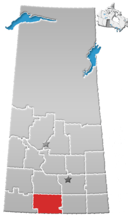
 Location of Hazenmore in Saskatchewan  Hazenmore (Canada) | |
| Coordinates: 49°41′13″N 107°08′17″W / 49.687°N 107.138°W | |
| Country |
|
| Province |
|
| Region | South-central |
| Census division | 3 |
| Rural Municipality | Pinto Creek No. 75 |
| Post office Founded | 1913 |
| Government | |
| • Type | Municipal |
| • Governing body | Hazenmore Village Council |
| • Mayor | Gary Loverin |
| • Administrator | Barb Switzer |
| • MP | David L. Anderson |
| • MLA | Wayne Elhard |
| Area | |
| • Total | 0.73 km2 (0.28 sq mi) |
| Population (2016) | |
| • Total | 70 |
| • Density | 96.2/km2 (249/sq mi) |
| Time zone | UTC-6 (CST) |
| Postal code | S0N 1C0 |
| Area code(s) | 306 |
| Highways |
|
| Railways | Great Western Railway |
| [1][2][3][4] | |
Hazenmore is a village within the Rural Municipality of Pinto Creek No. 75 in the province of Saskatchewan, Canada. The village had a population of 70 in the 2016 Canada Census, (a 40.0% increase from 50 in the 2011 Canada Census).
Demographics
| Canada census – Hazenmore community profile | |||
|---|---|---|---|
| 2016 | 2011 | 2006 | |
| Population: | 70 (40.0% from 2011) | 50 (-12.3% from 2006) | 57 (-19.7% from 2001) |
| Land area: | 0.73 km2 (0.28 sq mi) | 0.73 km2 (0.28 sq mi) | 0.80 km2 (0.31 sq mi) |
| Population density: | 96.2/km2 (249/sq mi) | 68.7/km2 (178/sq mi) | 71.1/km2 (184/sq mi) |
| Median age: | 31.5 (M: 31.5, F: 33.0) | 56.0 (M: 56.0, F: 56.0) | 57.5 (M: 58.5, F: 57.0) |
| Total private dwellings: | 34 | 34 | 36 |
| Median household income: | $Not Available | ||
| References: 2016[5] 2011[6] 2006[7] earlier[8] | |||
Infrastructure
Saskatchewan Transportation Company provides intercity bus service to Hazenmore.[9]
See also
The publicly-owned and subsidized provincial bus service known as the Saskatchewan Transit Corporation or STC no longer serves the people of the province by a conservative backed SaskParty and former premier Brad Wall in 2017.
References
- ↑ National Archives, Archivia Net, Post Offices and Postmasters
- ↑ Government of Saskatchewan, MRD Home, Municipal Directory System, archived from the original (– Scholar search) on November 21, 2008
- ↑ Canadian Textiles Institute. (2005), CTI Determine your provincial constituency, archived from the original on 2007-09-11
- ↑ Commissioner of Canada Elections, Chief Electoral Officer of Canada (2005), Elections Canada On-line
- ↑ "2016 Community Profiles". Canada 2016 Census. Statistics Canada. February 21, 2017.
- ↑ "2011 Community Profiles". Canada 2011 Census. Statistics Canada. July 5, 2013. Retrieved 2017-06-23.
- ↑ "2006 Community Profiles". Canada 2006 Census. Statistics Canada. March 30, 2011. Retrieved 2009-02-24.
- ↑ "2001 Community Profiles". Canada 2001 Census. Statistics Canada. February 17, 2012.
- ↑ STC Network Map Archived 2013-10-04 at the Wayback Machine.
External links
| Subdivisions | |
|---|---|
| Communities | |
| Cities | |
| Topics |
|
| |
Coordinates: 49°41′13″N 107°08′17″W / 49.687°N 107.138°W
This article is issued from
Wikipedia.
The text is licensed under Creative Commons - Attribution - Sharealike.
Additional terms may apply for the media files.