Stützerbach
| Stützerbach | ||
|---|---|---|
| ||
 Stützerbach Location of Stützerbach within Ilm-Kreis district 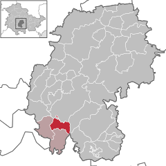  | ||
| Coordinates: 50°38′6″N 10°51′44″E / 50.63500°N 10.86222°ECoordinates: 50°38′6″N 10°51′44″E / 50.63500°N 10.86222°E | ||
| Country | Germany | |
| State | Thuringia | |
| District | Ilm-Kreis | |
| Municipal assoc. | Rennsteig | |
| Government | ||
| • Mayor | Frank Juffa (SPD) | |
| Area | ||
| • Total | 11.37 km2 (4.39 sq mi) | |
| Elevation | 620 m (2,030 ft) | |
| Population (2017-12-31)[1] | ||
| • Total | 1,364 | |
| • Density | 120/km2 (310/sq mi) | |
| Time zone | CET/CEST (UTC+1/+2) | |
| Postal codes | 98714 | |
| Dialling codes | 036784 | |
| Vehicle registration | IK | |
| Website | www.stuetzerbach.de | |

Stützerbach is a municipality in the Ilm-Kreis district, in Thuringia, Germany.
History
Within the German Empire (1871-1918), part of Stützerbach belonged to the Prussian Province of Saxony and part to the Grand Duchy of Saxe-Weimar-Eisenach.
References
This article is issued from
Wikipedia.
The text is licensed under Creative Commons - Attribution - Sharealike.
Additional terms may apply for the media files.