Gehlberg
| Gehlberg | ||
|---|---|---|
| ||
 Gehlberg Location of Gehlberg within Ilm-Kreis district 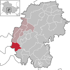  | ||
| Coordinates: 50°40′53″N 10°47′26″E / 50.68139°N 10.79056°ECoordinates: 50°40′53″N 10°47′26″E / 50.68139°N 10.79056°E | ||
| Country | Germany | |
| State | Thuringia | |
| District | Ilm-Kreis | |
| Municipal assoc. | Oberes Geratal | |
| Government | ||
| • Mayor | Hans Lehrke | |
| Area | ||
| • Total | 20.44 km2 (7.89 sq mi) | |
| Elevation | 720 m (2,360 ft) | |
| Population (2017-12-31)[1] | ||
| • Total | 502 | |
| • Density | 25/km2 (64/sq mi) | |
| Time zone | CET/CEST (UTC+1/+2) | |
| Postal codes | 98559 | |
| Dialling codes | 036845 | |
| Vehicle registration | IK | |
| Website | www.gehlberg.de | |

Gehlberg is a municipality in the district Ilm-Kreis, in Thuringia, Germany.
Twin towns — sister cities
Gehlberg is twinned with:

References
This article is issued from
Wikipedia.
The text is licensed under Creative Commons - Attribution - Sharealike.
Additional terms may apply for the media files.