Speed, Missouri
| Speed, Missouri | |
|---|---|
| Unincorporated community | |
 Speed | |
| Coordinates: 38°50′53″N 92°48′12″W / 38.84806°N 92.80333°WCoordinates: 38°50′53″N 92°48′12″W / 38.84806°N 92.80333°W[1] | |
| Country | United States |
| State | Missouri |
| County | Cooper County |
| Township | Palestine Township |
| Elevation[1] | 669 ft (204 m) |
| ZIP code | 65233 |
Speed is an unincorporated community in Palestine Township, Cooper County, Missouri, United States.
Geography
Speed is located along Missouri Route F on the west bank of Stevens Branch of Petite Saline Creek, four miles north of Bunceton. Booneville is nine miles to the north-northeast. The community of Bellair is two miles to the west on Missouri Route 5.[2]
History
Speed was originally named New Palestine, and under the latter name was laid out in 1868.[3] The present name is after Austin Speed, a railroad official.[3] A post office called New Palestine was established in 1869, the name was changed to Speed in 1898, and the post office closed in 1955.[4]
References
- 1 2 U.S. Geological Survey Geographic Names Information System: Speed, Missouri
- ↑ Missouri Atlas & Gazetteer, DeLorme, 1998, First edition, p. 37, ISBN 0-89933-224-2
- 1 2 "Cooper County Place Names, 1928–1945 (archived)". The State Historical Society of Missouri. Archived from the original on 24 June 2016. Retrieved 22 September 2016.
- ↑ "Post Offices". Jim Forte Postal History. Retrieved 22 September 2016.
Municipalities and communities of Cooper County, Missouri, United States | ||
|---|---|---|
| Cities | 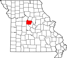 | |
| Villages | ||
| Townships | ||
| Unincorporated communities | ||
This article is issued from
Wikipedia.
The text is licensed under Creative Commons - Attribution - Sharealike.
Additional terms may apply for the media files.