Blackwater Township, Cooper County, Missouri
| Blackwater Township | |
|---|---|
| Township | |
 Location in Cooper County | |
| Coordinates: 38°58′05″N 92°59′39″W / 38.96806°N 92.99417°WCoordinates: 38°58′05″N 92°59′39″W / 38.96806°N 92.99417°W | |
| Country |
|
| State |
|
| County | Cooper |
| Area | |
| • Total | 25.26 sq mi (65.42 km2) |
| • Land | 24.88 sq mi (64.45 km2) |
| • Water | 0.37 sq mi (0.97 km2) 1.48% |
| Elevation | 636 ft (194 m) |
| Population (2000) | |
| • Total | 406 |
| • Density | 16.3/sq mi (6.3/km2) |
| Time zone | UTC-6 (CST) |
| • Summer (DST) | UTC-5 (CDT) |
| ZIP codes | 65322, 65347 |
| GNIS feature ID | 0766526 |
Blackwater Township is one of fourteen townships in Cooper County, Missouri, USA. As of the 2000 census, its population was 406.[1]
The township takes its name from Blackwater River.[2]
Geography
According to the United States Census Bureau, Blackwater Township covers an area of 25.26 square miles (65.42 square kilometers); of this, 24.88 square miles (64.45 square kilometers, 98.52 percent) is land and 0.37 square miles (0.97 square kilometers, 1.48 percent) is water.
Cities, towns, villages
Unincorporated towns
- Shackleford Crossing at 38°53′31″N 93°02′01″W / 38.8919643°N 93.0335307°W
(This list is based on USGS data and may include former settlements.)
Adjacent townships
- Arrow Rock Township, Saline County (north)
- Lamine Township (northeast)
- Pilot Grove Township (southeast)
- Clear Creek Township (south)
- Heath Creek Township, Pettis County (southwest)
Major highways
Lakes
- Embry Lake
- Horseshoe Lake
- Wilson Lake
School districts
- Pilot Grove C-4
Political districts
- Missouri's 6th congressional district
- State House District 117
- State Senate District 21
References
- United States Census Bureau 2008 TIGER/Line Shapefiles
- United States Board on Geographic Names (GNIS)
- United States National Atlas
- ↑ United States Census Bureau American FactFinder
- ↑ "Cooper County Place Names, 1928–1945 (archived)". The State Historical Society of Missouri. Archived from the original on 24 June 2016. Retrieved 24 September 2016.
External links
Places adjacent to Blackwater Township, Cooper County, Missouri | |
|---|---|
Municipalities and communities of Cooper County, Missouri, United States | ||
|---|---|---|
| Cities | 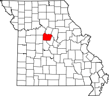 | |
| Villages | ||
| Townships | ||
| Unincorporated communities | ||
This article is issued from
Wikipedia.
The text is licensed under Creative Commons - Attribution - Sharealike.
Additional terms may apply for the media files.