Pilot Grove Township, Cooper County, Missouri
| Pilot Grove Township | |
|---|---|
| Township | |
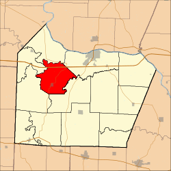 Location in Cooper County | |
| Coordinates: 38°52′56″N 92°54′07″W / 38.88222°N 92.90194°WCoordinates: 38°52′56″N 92°54′07″W / 38.88222°N 92.90194°W | |
| Country |
|
| State |
|
| County | Cooper |
| Area | |
| • Total | 36.18 sq mi (93.7 km2) |
| • Land | 35.94 sq mi (93.09 km2) |
| • Water | 0.24 sq mi (0.61 km2) 0.65% |
| Elevation | 814 ft (248 m) |
| Population (2000) | |
| • Total | 1,134 |
| • Density | 31.6/sq mi (12.2/km2) |
| Time zone | UTC-6 (CST) |
| • Summer (DST) | UTC-5 (CDT) |
| ZIP codes | 65233, 65276, 65322 |
| GNIS feature ID | 0766536 |
Pilot Grove Township is one of fourteen townships in Cooper County, Missouri, USA. As of the 2000 census, its population was 1,134.[1]
Geography
According to the United States Census Bureau, Pilot Grove Township covers an area of 36.18 square miles (93.7 square kilometers); of this, 35.94 square miles (93.09 square kilometers, 99.35 percent) is land and 0.24 square miles (0.61 square kilometers, 0.65 percent) is water.
Cities, towns, villages
Unincorporated towns
(This list is based on USGS data and may include former settlements.)
Adjacent townships
- Lamine Township (north)
- Boonville Township (east)
- Palestine Township (southeast)
- Clear Creek Township (southwest)
- Blackwater Township (northwest)
Cemeteries
The township contains these four cemeteries: Mount Vernon, Pleasant Hill, Saint Joseph and Saint Martin.
Major highways
School districts
- Boonville School District
- Pilot Grove C-4
Political districts
- Missouri's 6th congressional district
- State House District 117
- State Senate District 21
References
External links
Places adjacent to Pilot Grove Township, Cooper County, Missouri | |
|---|---|
Municipalities and communities of Cooper County, Missouri, United States | ||
|---|---|---|
| Cities | 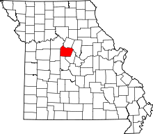 | |
| Villages | ||
| Townships | ||
| Unincorporated communities | ||
This article is issued from
Wikipedia.
The text is licensed under Creative Commons - Attribution - Sharealike.
Additional terms may apply for the media files.