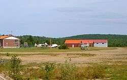
South River-Sundridge District Airport
| South River-Sundridge District Airport Sundridge/Almaguin Highlands Aerodrome Almaguin Highlands Air Park | |||||||||||||||
|---|---|---|---|---|---|---|---|---|---|---|---|---|---|---|---|
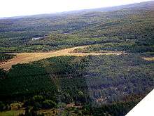 South view of the airport | |||||||||||||||
 South River-Sundridge District Airport | |||||||||||||||
| Summary | |||||||||||||||
| Airport type | Public | ||||||||||||||
| Owner | Sundridge/Joly | ||||||||||||||
| Operator | Sunridge/Almaguin Highlands Air Park | ||||||||||||||
| Location | South River-Sunridge, Ontario | ||||||||||||||
| Time zone | EST (UTC−05:00) | ||||||||||||||
| • Summer (DST) | EDT (UTC−04:00) | ||||||||||||||
| Elevation AMSL | 1,190 ft / 363 m | ||||||||||||||
| Coordinates | 45°49′21″N 079°19′25″W / 45.82250°N 79.32361°WCoordinates: 45°49′21″N 079°19′25″W / 45.82250°N 79.32361°W | ||||||||||||||
| Map | |||||||||||||||
 CPE6 Location in Ontario | |||||||||||||||
| Runways | |||||||||||||||
| |||||||||||||||
|
Source: Canada Flight Supplement[1] | |||||||||||||||
South River-Sundridge District Airport, (TC LID: CPE6), is a registered aerodrome located 2.6 nautical miles (4.8 km; 3.0 mi) southeast of South River, Ontario, Canada, in the township of Joly.
References
- ↑ Canada Flight Supplement. Effective 0901Z 19 July 2018 to 0901Z 13 September 2018.
| By name | |
|---|---|
| By location indicator | |
| By province/territory | |
| By area | |
| National Airports System | |
| Related | |
| |
This article is issued from
Wikipedia.
The text is licensed under Creative Commons - Attribution - Sharealike.
Additional terms may apply for the media files.